13 July 2013
 

TAREK MOKHTAR EL ASWED

Research

My future research plans are to build on the foundation of my PhD to further develop models and tools in conjunction with government bodies, environment agencies. I have a particular interest in the hydrological, environmental and geological studies utilize remotely sensed data by different image processing methods and geographical information system.

Education

  • Jan 2005- June 2009, PhD: – Geography, School of Social Sciences, Dundee University, UK.

Project Title: “Remote sensing the impact of Groundwater changes on Agricultural activities in the north-western Libya”.

  • Oct 1997 – July 1999, MSc in Remote Sensing, Image Processing and Applications, Department of Applied Physics and Electronic and Manufacturing Engineering, Dundee University, UK.

Dissertation Title: -“Urban Change Detection based on a Supervised Classification   Approach using Spot XS and Landsat TM Images”.

  • Sep 1986 – Oct 1989, B.Sc. Soil and Water Engineering department, Agriculture college, Al-Fatah University, Tripoli, Libya.

Dissertation Title: – Irrigation System designing

Work Experience

-    Jan 2011- in present, Full time job as a lecturer, teaching in remote sensing and geographic information systems, Geography Department, Art collage,  Az Zawia University.

-    Aug 2010- Dec 2010, A director of Aerial photography and mapping department in Biruni Remote Sensing Center.

-    Jan 2010- Jan 2011, Part time job as a lecturer, teaching in Earth sources and geographic information systems, Earth sources Department, Agriculture collage, Al-Fatah university, Tripoli-Libya


-    Oct 2009- Dec 2010, Part time job as a lecturer, teaching in remote sensing and geographic information systems, Geography Department, Almrgbe University, Tarhona-Libya.


-    Oct 2009- Aug 2010, full time as researcher in Libyan Remote Sensing Center and Space Science.


-    June 2008- June 2009, Part time research assistant to a research group of Remote Sensing/Image Analysis, Environmental Science Division of Plant Sciences College of Life Sciences, University of Dundee.


-    Mar 2005- May 2008 Demonstrator and teaching in Level 1 Environmental Science (IT induction), and Level 2 Environmental Science (image processing using ERDAS).

-    Oct 2006- Dec 2007 Demonstrator and teaching assistant as required in Hydrology Workshops in Level 1 Environmental Science.


-    Oct 2006- Dec 2007 Demonstrator and teaching assistant as required in GIS module in Level 3 Environmental Science.


-    Nov 1995– Jan 2005 Biruni Remote Sensing Center (BRSC), Tripoli, Libya. Tasks included image processing and remote sensing applications analyst. During these posts I have developed my skills in remote sensing, as well as the following computer skills: Microsoft Office facilities, CorelDraw Graphics, Paint Shop Pro Photo, Image processing packages (including ERDAS Imagine, ENVI and ER Mapper) and GIS (including Arc GIS) packages. From Oct 2002- Nov 2004 a director of Application remote sensing department.


- Feb 1992- Sep 1995 Agriculture Ministry, El Zawia –Libya.   Task: Member of management staff. E.g. provide advises to farmers and run agriculture activities programs.

-    Jan 1990- July 1991 Voluntary work “military service”.


Training

-    Space cartography course, by GDTA professional training in satellite imagery applications, 8th – 19th of April 2002. Ramonville St-Agne Cedex, France


-    ER Mapper advanced training course, by the Earth Resource Mapping, 9th – 17th of December 2002. London, UK


Memberships 

  • A member in United Kingdom Remote Sensing and Photgrammatry society


Interests

Traveling to discover other cultures, swimming and playing football, reading books, meeting people and making new friends.


2

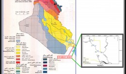
Determine the morphostructure phenomenon, East Khor Al-Zubair by Space Imageries

Dr.TorhanAlmofti *                                         Ahmed Ibrahim Saleh Al-Naemi** Abstract Through the use of satellite data taken by the Landsat satellites a color phenomenon was...
by Lamouchi Helmi
0


1

Detection and monitoring crop of wheat and barley by using NDVI stacking technique and spectral angle mapper algorithm

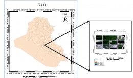
S K AAl-Hummadi[1] N S Nuaimy[2] A L Ubaidy[3] 1Ministry of science and Technology, ,Remote sensing center, Iraq E-mail: shathamaster@yahoo.com   2Ministry of science and Technology, Remote sensing center, Iraq E-mail: ade...
by Lamouchi Helmi
0


2

Tunisian economy in the face of the Covid-19 pandemic: State of play, analysis and outlook

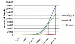
Bouzayani Rajab [1]/ Abida Zouheir[2] [1] Bouzayani Rajab : Faculty of Economics and Management of Sfax, University of Sfax – Tunisia. E-mail: bouzayanilazher@gmail.com [2] Abida Zouheir : Faculty of Economics and Mana...
by Lamouchi Helmi
0


Thumbnail.8.640.360

Reducing Total Freshwater Use in the Gold Processing Industry Using Linear Programming

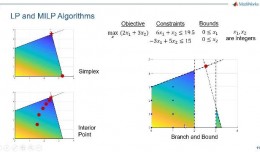
Suliman Emdini Gliwan*1 Kevin Crowe *2 *1Ph.D.Candidate, Faculty of Natural Resource Management, Lakehead University, 955 Oliver Rd, Thunder Bay, ON, Canada (P7B5E1). *2Associate Professor, Faculty of Natural Resource Managemen...
by Lamouchi Helmi
0


06-731x413

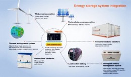
Control of a Hybrid Wind-PV and Energy Storage System

Control of a Hybrid Wind-PV and Energy Storage System Mohammed Al Busaidi, Amer Al-Hinai*, Rashid Al-Abri, Mohammed Al-Badi Electrical & Computer Engineering, Sultan Qaboos University, Oman Abstract—Distributed energy gen...
by Lamouchi Helmi
0


images

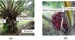
Modeling Ripeness Grading of Palm Oil Fresh Fruit Bunches through Image Processing using Artificial Neural Network

Modeling Ripeness Grading of Palm Oil Fresh Fruit Bunches through Image Processing using Artificial Neural Network Osama M. Ben Saaed1, Meftah Salem M Alfatni1,2*, Abdul Rashid Mohamed Shariff3 and Hadya S Hawedi1 1Faculty of I...
by Lamouchi Helmi
0


maxresdefault

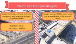
DETECTIONS OF BUILDINGSDIGITAL SURFACE MODELS DEFORMATIONS GENERATED FROM DRONES NADIR IMAGES

  DETECTIONS OF BUILDINGSDIGITAL SURFACE MODELS DEFORMATIONS GENERATED FROM DRONES NADIR IMAGES Jean A. Doumit*, Souhail F. Awad*,Evgeny N. Kiselev** *Lebanese University, Faculty of Letters and Human Sciences, Department of g...
by Lamouchi Helmi
0


Prezentacja programu PowerPoint

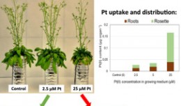
Comparative responses to cadmium toxicity of Arabidopsis thaliana mutant seedling (cad2) and wild type (col0)

Comparative responses to cadmium toxicity of Arabidopsis thaliana mutant seedling (cad2) and wild type (col0) CHAFFEI HAOUARI CHIRAZ1, SLATNI TARAK2, DJEMAL FATMA1, GOUIA HOUDA1 (Company / Faculté des Sciences de Tunis) 1Unive...
by Lamouchi Helmi
0


1320_effects-image

Precision Technologies Role in the Study of Climate Change Impact

The Second session of the International Symposium Precision Technologies Role in the Study of Climate Change Impact and its implications on the Economic and Natural Structure: The reality and suggested solutions Istanbul, Turke...
by Lamouchi Helmi
0


f0ecbd2a-2ed9-458d-91ab-07e1caedea10-9867cc4df536.small

5th International Conference on Water, Energy, Food and Agricultural Technology Istanbul, Turkey, 22-25 January 2019

5th International Conference on Water, Energy, Food and Agricultural Technology Istanbul, Turkey, 22-25 January 2019   Scientific themes 1-      water resources and desertification and agricultural techniques 2-   ...
by Lamouchi Helmi
0


wwwwww

Drone base multiscale Digital Surface Models to planar areas.

Drone base multiscale Digital Surface Models to planar areas. Dr. Jean A. Doumit   Abstract The obtaining of a Digital Surface models (DSMs) at different scales and levels before the appearance of Unmanned Aerial Vehicles (UAV...
by Lamouchi Helmi
0


1

Monitoring of Mosul Reservoir Using Remote Sensing TechniquesFor the Period After ISIS Attack in 9 June 2014

Monitoring of Mosul Reservoir Using Remote Sensing TechniquesFor the Period After ISIS Attack in 9 June 2014 Lecture:  Muthanna Mohammed Abdulhameed AL Bayati University of Technology – Baghdad- Building and Construction Dep...
by Lamouchi Helmi
0