19860728

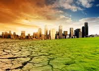
New Public Application of Landsat Images Released

Google released more than a quarter-century of images of Earth taken from space Thursday compiled into an interactive time-lapse experience. Working with data from the Landsat Program managed by the U.S. Geological Survey, the ...
by Lamouchi Helmi
0


images

Urgent Action Needed on Climate Change in Arab World

New report charts current and future damage from the region’s rapidly changing climate and calls for strong leadership in preparing countries and communities to face the threat      WASHINGTON, December 5, 2012 – The ...
by Lamouchi Helmi
0


VV02 retrait portique

ESA’S VEGA LAUNCHER SCORES NEW SUCCESS WITH PROBA-V

The second flight of ESA’s newest launch vehicle has been completed from Europe’s Spaceport in Kourou, French Guiana. Two Earth observation satellites, ESA’s Proba-V and Vietnam’s VNREDSat‑1A, were released into diffe...
by Lamouchi Helmi
0


717827main_pia16609-673

NASA Telescopes See Weather Patterns in Brown Dwarf

PASADENA, Calif. — Astronomers using NASA’s Spitzer and Hubble space telescopes have probed the stormy atmosphere of a brown dwarf, creating the most detailed “weather map” yet for this class of cool, st...
by Lamouchi Helmi
0


téléchargement

Learn to Use Esri’s Collector for ArcGIS on Your Smartphone

You can work with maps in the field using Esri’s Collector for ArcGIS app on your iPhone or Android smartphone. You can also use maps to capture spatial and tabular data with the phone’s GPS or by tapping on the map...
by Lamouchi Helmi
0


image4a

Forest products industry slowly recovers from recession

18 December 2012, Rome - The global forest products industry is slowly recovering from the economic crisis, with the Asia-Pacific region and particularly China taking the lead. New data published by FAO indicate that on avera...
by Lamouchi Helmi
0


p3-gulfstream

AeroMetric Announces New High Accuracy Mapping Solution

Sheboygan, Wisconsin, May 23, 2013 – AeroMetric announced the addition of a new High Accuracy Mapping Solution for its clients. The new solution is designed to obtain tight vertical accuracy and highly detailed imagery...
by Lamouchi Helmi
0


sig_

Geographic information system

Geographic information system (GIS) is a system designed to capture, store, manipulate, analyze, manage, and present all types of geographical data. The acronym GIS is sometimes used for geographical information science or geos...
by Geo-SP
0


Alphasat_1-XL_large

Alphabus/Alphasat

ARTES 8 Alphabus/Alphasat is dedicated to the development and deployment of the Alphasat satellite. Alphasat is being built in partnership between ESA and European operator Inmarsat by Astrium. It is the first satellite to us...
by Lamouchi Helmi
0