About us
Books and letters
Calendar
Contact
Evaluation Committee
Events
Publishing Guide
Reporting Geo-sp
Submit new event
Titles of published researches
English
Français
العربية
Home
About us
Evaluation Committee
Publishing Guide
Research
Interviews
Events
Books and letters
Books
Contact
Sort
Recent
Most Commented
Random
Published Researches
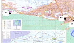
Spatial assessment of water quality data in a’seeb area, Oman using gis
by Ali Neji
0
Full Review »
Published Researches
Atmospheric PM10 pollution in the mining basin of Gafsa (south-western of Tunisia): statistical analysis and cartography
by Ali Neji
0
Full Review »
Published Researches
Mapping of water nitrogen pollution from agricultural sources in Poland
by Ali Neji
0
Full Review »
Published Researches
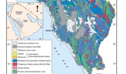
Satellite Tech-Identification of Groundwater Offshore Springs in Red Sea along Jeddah-Rabigh Costal Belt: A Case of Fault-Zone-Aquifers in Crystalline Rocks of Arabian Shield
by Ali Neji
0
Full Review »
Published Researches
Evaluation of land suitability using fuzzy logic in the north west of Libya
by Ali Neji
0
Full Review »
Published Researches
Using QuickBird Satellite Images to Study Salinity Effect on Date Palm Field
by Ali Neji
0
Full Review »
Published Researches
Scale effects in the assessment of digital terrain models and slope maps
by Ali Neji
0
Full Review »
Published Researches
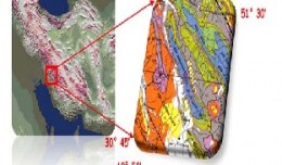
Preparing digital lineament map of bangestan structure, using satellite data and remote sensing techniques
by Ali Neji
0
Full Review »
Published Researches
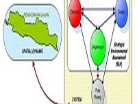
“Integration of system dynamic and spatial dynamic models to support regional development planning” (case study in java madura bali)
by Ali Neji
0
Full Review »
Page 7 of 8
« First
‹ Previous
4
5
6
7
8
Next ›
The Latest
News
Articles and Interviews
Reporting Geo-sp
Published Researches
Precision Technologies Role in the Study of Climate Change Impact
5th International Conference on Water, Energy, Food and Agricultural Technology Istanbul, Turkey, 22-25 January 2019
10th edition of the International Congress & technologies dedicated to geospatial applications
Bluesky’s LiDAR experts educate Mouchel’s water industry professionals
Creation of a digital 3-dimensional model
AeroMetric Announces New High Accuracy Mapping Solution
Interview with George Gartner
Measuring earth’s vital magnetic field
Determine the morphostructure phenomenon, East Khor Al-Zubair by Space Imageries
Detection and monitoring crop of wheat and barley by using NDVI stacking technique and spectral angle mapper algorithm
Tunisian economy in the face of the Covid-19 pandemic: State of play, analysis and outlook
More »
More »
More »
More »
 English
  Français
  العربية