Archive for April 2024


img_1322557545_891

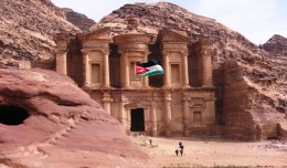
Director General of the Royal Jordanian Geographic center A member of the Scientific Council of the international congress Geotunis

Director General of The Royal Jordanian Geographic center Dr. Dean. Engineer Director General Ouni Hdhawna was chosen as a member of the scientific council of the international congress Geotunis 7thedition which will be held fr...
by Lamouchi Helmi
0


basrahuniv (Large)

University of literature of Basra holds its 5th edition of the Scientific Congress

  Geo SP has been informed that the University of Basra in south of Iraq is preparing the 5th edition of its scientific congress in mid spring 2013. The congress which will be sponsored by the president of the University o...
by Lamouchi Helmi
0


700760main_ST_equidistant_orbit-466

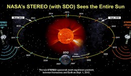
NASA Spacecraft Observe Nov. 20 Solar Eruption

On Nov. 20, 2012, at 7:09 a.m. EST, the sun erupted with a coronal mass ejection or CME. Not to be confused with a solar flare, a CME is a solar phenomenon that can send solar particles into space and can reach Earth one to thr...
by Lamouchi Helmi
0


707628main_pia16294-946

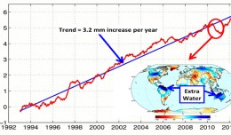
Global Sea Level

    This figure shows changes in global mean sea level as measured by satellite altimetry (NASA/CNES Topex/Poseidon and Jason-1; and NASA/CNES/NOAA/EUMETSAT Jason-2) between 1992 to 2012. The data have been averaged t...
by Lamouchi Helmi
0


desert0813 (1)

The second Scientific Congress of the Desert Studies Center: Anabar University/ Iraq

The second Scientific Congress of the Desert Studies Center: Anabar University/ Iraq December 24 to December 26, 2012 The Desert Studies Center in Iraq organizes the second scientific congress from December 24 to December 26,...
by Lamouchi Helmi
0


DSC_0587

5th International Conference on Water Resources and Arid Environments

5th International Conference on Water Resources and Arid Environments 7-9 January 2013 Organizers: Prince Sultan Bin Abdulaziz International Prize for Water (PSIPW) King Saud University, represented by the Prince Sultan Institu...
by Lamouchi Helmi
0


magn

Measuring earth’s vital magnetic field

 
by Geo-SP
0


sig_

Geographic information system

Geographic information system (GIS) is a system designed to capture, store, manipulate, analyze, manage, and present all types of geographical data. The acronym GIS is sometimes used for geographical information science or geos...
by Geo-SP
0


climate_change_0218

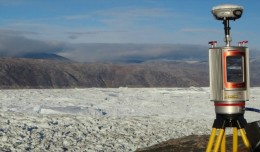
RIEGL launches VZ-6000 Terrestrial Laser Scanner

          RIEGL goes for ultra-long ranges: VZ-6000 offers more than 6,000 m measurement range Horn, Austria, September 24, 2012 – Especially designed for ultra-long range applications in topograp...
by Lamouchi Helmi
0