News

11 November 2012

Climate Likely to Be on Hotter Side of Projections


A new NASA-funded study by the National Center for Atmospheric Research, Boulder, Colo., finds climate model projections that show a greater rise in global temperature are likely to prove more accurate than those showing a lesser rise. The findings, published today in the journal Science, could provide a breakthrough in the longstanding quest to narrow the range of global warming expected in coming decades and beyond.

National Center for Atmospheric Research scientists John Fasullo and Kevin Trenberth analyzed how well 16 leading sophisticated climate models reproduce observed relative humidity in Earth’s tropics and subtropics. They used observations from two NASA satellite instruments – the Atmospheric Infrared Sounder (AIRS) instrument on NASA’s Aqua spacecraft and the Clouds and Earth’s Radiant Energy System (CERES) instruments that fly on several NASA Earth satellites – along with a NASA data analysis called the Modern-Era Retrospective Analysis for Research and Applications (MERRA). AIRS was built by and is managed by NASA’s Jet Propulsion Laboratory, Pasadena, Calif. NASA’s Langley Research Center, Hampton, Va., manages the CERES mission.

The researchers found the climate models that most accurately captured these complex moisture processes and associated clouds, which have a major influence on global climate, were also the ones that showed the greatest amounts of warming as society emits more greenhouse gases into the atmosphere.

“There is a striking relationship between how well climate models simulate relative humidity in key areas and how much warming they show in response to increasing carbon dioxide,” said Fasullo. “Given how fundamental these processes are to clouds and the overall global climate, our findings indicate that warming is likely to be on the high side of current projections.”

The world’s major global climate models are all based on long-established physical laws known to guide the atmosphere. However, because these relationships are challenging to translate into software, each model differs slightly in its portrayal of global climate. In particular, some processes, such as those associated with clouds, are too small to be represented properly. Although satellites observe many types of clouds, satellite failure, observing errors and other inconsistencies make it challenging to build a comprehensive global cloud census that is consistent over many years.

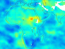
However, satellites perform better in measuring water vapor, and estimates of the global distribution of relative humidity, such as provided by AIRS, have become more reliable. Relative humidity also is incorporated in climate models to generate and dissipate clouds.

The authors focused on the dry subtropics because seasonal drying and associated decrease in clouds there, especially during May through August, serve as a good analog for patterns projected by climate models. “If we can better represent these regions in models, we can improve our predictions and provide society with a better sense of the impacts to expect in a warming world,” said Fasullo.


AIRS project scientist Eric Fetzer of JPL, who was not involved with the study, called the work both encouraging and sobering. “These results were hiding in plain sight,” he said. “We have known for 30 years that clouds complicate climate forecasts, but instead of looking directly at clouds, this study examines clear regions. Their conclusions indicate that better model physics for clear areas will lead to improved climate forecasts, but warming is likely to be at the high end of current forecasts.”

Launched in 2002, AIRS, along with its partner microwave instrument, the Advanced Microwave Sounding Unit (AMSU-A), measures Earth’s atmospheric temperature, water vapor, clouds and greenhouse gases with unprecedented accuracy and stability. Over the past decade, AIRS and AMSU-A have improved our understanding of Earth’s global water and energy cycles, climate change and trends and how Earth’s climate system is responding to increased greenhouse gases. For more on AIRS, visit: http://airs.jpl.nasa.gov/.

For more on the study, read the full NCAR news release at: https://www2.ucar.edu/atmosnews/news/8264/future-warming-likely-be-high-side-climate-projections-analysis-finds.


2

Determine the morphostructure phenomenon, East Khor Al-Zubair by Space Imageries

Dr.TorhanAlmofti *                                         Ahmed Ibrahim Saleh Al-Naemi** Abstract Through the use of satellite data taken by the Landsat satellites a color phenomenon was...
by Lamouchi Helmi
0


1

Detection and monitoring crop of wheat and barley by using NDVI stacking technique and spectral angle mapper algorithm

S K AAl-Hummadi[1] N S Nuaimy[2] A L Ubaidy[3] 1Ministry of science and Technology, ,Remote sensing center, Iraq E-mail: shathamaster@yahoo.com   2Ministry of science and Technology, Remote sensing center, Iraq E-mail: ade...
by Lamouchi Helmi
0


2

Tunisian economy in the face of the Covid-19 pandemic: State of play, analysis and outlook

Bouzayani Rajab [1]/ Abida Zouheir[2] [1] Bouzayani Rajab : Faculty of Economics and Management of Sfax, University of Sfax – Tunisia. E-mail: bouzayanilazher@gmail.com [2] Abida Zouheir : Faculty of Economics and Mana...
by Lamouchi Helmi
0


Thumbnail.8.640.360

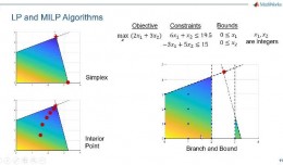
Reducing Total Freshwater Use in the Gold Processing Industry Using Linear Programming

Suliman Emdini Gliwan*1 Kevin Crowe *2 *1Ph.D.Candidate, Faculty of Natural Resource Management, Lakehead University, 955 Oliver Rd, Thunder Bay, ON, Canada (P7B5E1). *2Associate Professor, Faculty of Natural Resource Managemen...
by Lamouchi Helmi
0


06-731x413

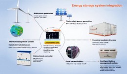
Control of a Hybrid Wind-PV and Energy Storage System

Control of a Hybrid Wind-PV and Energy Storage System Mohammed Al Busaidi, Amer Al-Hinai*, Rashid Al-Abri, Mohammed Al-Badi Electrical & Computer Engineering, Sultan Qaboos University, Oman Abstract—Distributed energy gen...
by Lamouchi Helmi
0


images

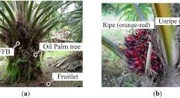
Modeling Ripeness Grading of Palm Oil Fresh Fruit Bunches through Image Processing using Artificial Neural Network

Modeling Ripeness Grading of Palm Oil Fresh Fruit Bunches through Image Processing using Artificial Neural Network Osama M. Ben Saaed1, Meftah Salem M Alfatni1,2*, Abdul Rashid Mohamed Shariff3 and Hadya S Hawedi1 1Faculty of I...
by Lamouchi Helmi
0


maxresdefault

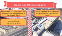
DETECTIONS OF BUILDINGSDIGITAL SURFACE MODELS DEFORMATIONS GENERATED FROM DRONES NADIR IMAGES

  DETECTIONS OF BUILDINGSDIGITAL SURFACE MODELS DEFORMATIONS GENERATED FROM DRONES NADIR IMAGES Jean A. Doumit*, Souhail F. Awad*,Evgeny N. Kiselev** *Lebanese University, Faculty of Letters and Human Sciences, Department of g...
by Lamouchi Helmi
0


Prezentacja programu PowerPoint

Comparative responses to cadmium toxicity of Arabidopsis thaliana mutant seedling (cad2) and wild type (col0)

Comparative responses to cadmium toxicity of Arabidopsis thaliana mutant seedling (cad2) and wild type (col0) CHAFFEI HAOUARI CHIRAZ1, SLATNI TARAK2, DJEMAL FATMA1, GOUIA HOUDA1 (Company / Faculté des Sciences de Tunis) 1Unive...
by Lamouchi Helmi
0


1320_effects-image

Precision Technologies Role in the Study of Climate Change Impact

The Second session of the International Symposium Precision Technologies Role in the Study of Climate Change Impact and its implications on the Economic and Natural Structure: The reality and suggested solutions Istanbul, Turke...
by Lamouchi Helmi
0


f0ecbd2a-2ed9-458d-91ab-07e1caedea10-9867cc4df536.small

5th International Conference on Water, Energy, Food and Agricultural Technology Istanbul, Turkey, 22-25 January 2019

5th International Conference on Water, Energy, Food and Agricultural Technology Istanbul, Turkey, 22-25 January 2019   Scientific themes 1-      water resources and desertification and agricultural techniques 2-   ...
by Lamouchi Helmi
0


wwwwww

Drone base multiscale Digital Surface Models to planar areas.

Drone base multiscale Digital Surface Models to planar areas. Dr. Jean A. Doumit   Abstract The obtaining of a Digital Surface models (DSMs) at different scales and levels before the appearance of Unmanned Aerial Vehicles (UAV...
by Lamouchi Helmi
0


1

Monitoring of Mosul Reservoir Using Remote Sensing TechniquesFor the Period After ISIS Attack in 9 June 2014

Monitoring of Mosul Reservoir Using Remote Sensing TechniquesFor the Period After ISIS Attack in 9 June 2014 Lecture:  Muthanna Mohammed Abdulhameed AL Bayati University of Technology – Baghdad- Building and Construction Dep...
by Lamouchi Helmi
0


0 comments »


Be the first to comment!


Leave a Reply

Your email address will not be published. Required fields are marked *

*

* Copy This Password *

* Type Or Paste Password Here *

You may use these HTML tags and attributes: <a href="" title=""> <abbr title=""> <acronym title=""> <b> <blockquote cite=""> <cite> <code> <del datetime=""> <em> <i> <q cite=""> <strike> <strong>