13 July 2013

CHANGE DETECTION IN HOUR-IBN NAJAM / MIDDLE OF IRAQ BY USING WATER INDEX (W.I) ALGBRA

Abstract

Sans titre

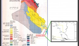
The marshes of Iraq’s considers natural wealth  and which is gaining importance for their impacts to the environment and economic aspects, and HOUR-IBN NAJAM (or so-called HOUR-ABO NAJAM) is one of the important marshes in IRAQ,  this hour located in three provinces, Najaf, Babil and Qadisiyah.

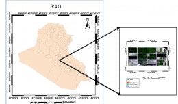
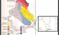
The study area is located between longitude (44.20, 44.45E) and latitude (32.16, 32.50 N), covering an estimated area (2160 km²).
    Change detection is one of the most widely used processing techniques in remote sensing. It is a process of identifying differences in the state of a geographic feature or phenomenon by monitoring at different times.

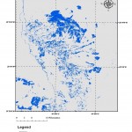
In order to detect the changes after a phenomenon, used function Water Index (WI) to identify changes in water content of the Hour during periods of multiple time dates.

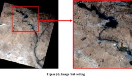
Landsat satellite data was used of sensors MSS for the years 1974.1992 and sensors TM 1984 and ETM sensors for the years 2006, 2003, 2009.
Using Arc GIS software we converted the results to thematic maps represent water index coefficient of water through multiple years, as well as the use of  Erase tool in the toolbox in the Arc GIS software in order to find out the increase and decrease of the water content of the Hour during the past years.

The results showed that there is an increase in water content of the hour in 1974 and 1984 and 1992 with an areas 210, 237, 219 km2 and a decrease between 2003, 2006, 2009 with an areas 52, 58, 74 km2, respectively.

Writer
ZEYAD JAMEEL AL-SAEDI

-         Summery of Qualifications 1-    B.Sc.in Science /University of Baghdad-Collage of Science-Depts. of Geology- 1999.
2-    M.Sc. Specialist in Geomorphology & Remote Sensing -2009.
-   Summery of Courses 1-    Negotiation – 2005 2-    Excel -2006 3-    Primary Arc GIS-2010
4-    Training of trainer (T.O.T)-2010 5-    Capacity Building on Remote Sensing and Geographic Information System For Iraq/held in Turkey-2011
  -    Professional Experiences 1-    Start work in State Company of water well drilling in (2001). Recently the name of this company is (General commission of groundwater). 2-    Recently work in National Center of water management since 15/3/2010. 3-    I have a research published in Iraqi Journal of science. Titled "Using Arc GIS to determine some landforms in Salman depression-South Iraq". 4-    Research published in Iraqi Geographical Magazine. Titled "Using NDVI algebra to identify changes in Ha'danya depression/South IRAQ". 5-     Research published in Iraqi Geographical Magazine. Titled" Remote Sensing and GIS Application in Land Cover Detection Study/ BAGHDA City Using Multi-Temporal Satellite Data". 6-      Participate in First International Conference of Remote Sensing and Image Processing in research tilted " CHANGE DETECTION IN HOUR-IBN NAJAM / MIDDLE OF IRAQ BY USING WATER INDEX (W.I) ALGBRA" 7- Lecturer for Remote Sensing Subject. 8 - Good user to Microsoft office (Word, Power point, and Excel) as well as the Internet.
9       -Experiences in Satellite Images & Remote Sensing.
  -   Languages 1-    Arabic (Native language)
2-    English
 

Full Research


2

Determine the morphostructure phenomenon, East Khor Al-Zubair by Space Imageries

Dr.TorhanAlmofti *                                         Ahmed Ibrahim Saleh Al-Naemi** Abstract Through the use of satellite data taken by the Landsat satellites a color phenomenon was...
by Lamouchi Helmi
0


1

Detection and monitoring crop of wheat and barley by using NDVI stacking technique and spectral angle mapper algorithm

S K AAl-Hummadi[1] N S Nuaimy[2] A L Ubaidy[3] 1Ministry of science and Technology, ,Remote sensing center, Iraq E-mail: shathamaster@yahoo.com   2Ministry of science and Technology, Remote sensing center, Iraq E-mail: ade...
by Lamouchi Helmi
0


2

Tunisian economy in the face of the Covid-19 pandemic: State of play, analysis and outlook

Bouzayani Rajab [1]/ Abida Zouheir[2] [1] Bouzayani Rajab : Faculty of Economics and Management of Sfax, University of Sfax – Tunisia. E-mail: bouzayanilazher@gmail.com [2] Abida Zouheir : Faculty of Economics and Mana...
by Lamouchi Helmi
0


Thumbnail.8.640.360

Reducing Total Freshwater Use in the Gold Processing Industry Using Linear Programming

Suliman Emdini Gliwan*1 Kevin Crowe *2 *1Ph.D.Candidate, Faculty of Natural Resource Management, Lakehead University, 955 Oliver Rd, Thunder Bay, ON, Canada (P7B5E1). *2Associate Professor, Faculty of Natural Resource Managemen...
by Lamouchi Helmi
0


06-731x413

Control of a Hybrid Wind-PV and Energy Storage System

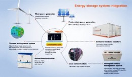
Control of a Hybrid Wind-PV and Energy Storage System Mohammed Al Busaidi, Amer Al-Hinai*, Rashid Al-Abri, Mohammed Al-Badi Electrical & Computer Engineering, Sultan Qaboos University, Oman Abstract—Distributed energy gen...
by Lamouchi Helmi
0


images

Modeling Ripeness Grading of Palm Oil Fresh Fruit Bunches through Image Processing using Artificial Neural Network

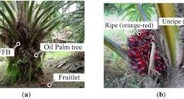
Modeling Ripeness Grading of Palm Oil Fresh Fruit Bunches through Image Processing using Artificial Neural Network Osama M. Ben Saaed1, Meftah Salem M Alfatni1,2*, Abdul Rashid Mohamed Shariff3 and Hadya S Hawedi1 1Faculty of I...
by Lamouchi Helmi
0


maxresdefault

DETECTIONS OF BUILDINGSDIGITAL SURFACE MODELS DEFORMATIONS GENERATED FROM DRONES NADIR IMAGES

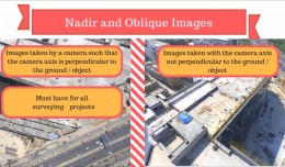
  DETECTIONS OF BUILDINGSDIGITAL SURFACE MODELS DEFORMATIONS GENERATED FROM DRONES NADIR IMAGES Jean A. Doumit*, Souhail F. Awad*,Evgeny N. Kiselev** *Lebanese University, Faculty of Letters and Human Sciences, Department of g...
by Lamouchi Helmi
0


Prezentacja programu PowerPoint

Comparative responses to cadmium toxicity of Arabidopsis thaliana mutant seedling (cad2) and wild type (col0)

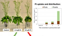
Comparative responses to cadmium toxicity of Arabidopsis thaliana mutant seedling (cad2) and wild type (col0) CHAFFEI HAOUARI CHIRAZ1, SLATNI TARAK2, DJEMAL FATMA1, GOUIA HOUDA1 (Company / Faculté des Sciences de Tunis) 1Unive...
by Lamouchi Helmi
0


1320_effects-image

Precision Technologies Role in the Study of Climate Change Impact

The Second session of the International Symposium Precision Technologies Role in the Study of Climate Change Impact and its implications on the Economic and Natural Structure: The reality and suggested solutions Istanbul, Turke...
by Lamouchi Helmi
0


f0ecbd2a-2ed9-458d-91ab-07e1caedea10-9867cc4df536.small

5th International Conference on Water, Energy, Food and Agricultural Technology Istanbul, Turkey, 22-25 January 2019

5th International Conference on Water, Energy, Food and Agricultural Technology Istanbul, Turkey, 22-25 January 2019   Scientific themes 1-      water resources and desertification and agricultural techniques 2-   ...
by Lamouchi Helmi
0


wwwwww

Drone base multiscale Digital Surface Models to planar areas.

Drone base multiscale Digital Surface Models to planar areas. Dr. Jean A. Doumit   Abstract The obtaining of a Digital Surface models (DSMs) at different scales and levels before the appearance of Unmanned Aerial Vehicles (UAV...
by Lamouchi Helmi
0


1

Monitoring of Mosul Reservoir Using Remote Sensing TechniquesFor the Period After ISIS Attack in 9 June 2014

Monitoring of Mosul Reservoir Using Remote Sensing TechniquesFor the Period After ISIS Attack in 9 June 2014 Lecture:  Muthanna Mohammed Abdulhameed AL Bayati University of Technology – Baghdad- Building and Construction Dep...
by Lamouchi Helmi
0


0 comments »


Be the first to comment!


Leave a Reply

Your email address will not be published. Required fields are marked *

*

* Copy This Password *

* Type Or Paste Password Here *

You may use these HTML tags and attributes: <a href="" title=""> <abbr title=""> <acronym title=""> <b> <blockquote cite=""> <cite> <code> <del datetime=""> <em> <i> <q cite=""> <strike> <strong>