5 November 2012

“Integration of system dynamic and spatial dynamic models to support regional development planning” (case study in java madura bali)

Abstract

Main Structure of Regional Development Planning

Nowadays, development planning in Indonesia needs to consider more spatial and environment aspects to reach sustainability development goal optimally. One of group islands located in Indonesia is Java-Madura-Bali, which it’s improvement planning based on Sector which it’s relation of one area to others still less be focused.  In supporting development planning system that focused on regional and sector aspects, supporting spatial data and approaching that integrated between dynamic and spatial system is more needed.

Planning based on system dynamic model shows each variable connected to certain area system can be determined one to others which this matter close to real situation. This Point of view would be remained us about real life that the connection of those variables is an object to occur the changes.

The approaching of system dynamic has done to obtain landuse needs based on simulation of behavior from phenomenon occur in a system. Simulation is conducted by inputting policy factor/ intervention (based on scenario used) to system dynamic model frame. The Change of policy will be influencing to other variable so it will be affected performance system in reaching a required landuse need.

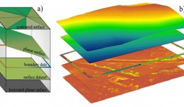
Spatial model represent development behavior from spatial pattern of a region system. By Modelling Spatial, it can be used to simulate a goal in improving an area by viewing the changes that happened  periodically. By this case, it can be used to predict the beyond needs about the changes that probably happened in one area.. Spatial modeling Technic which is used based on raster analysis (grid-based spatial analysis). In every cell has a value representing many kind of location quality such as : elevation, slope, etc. Value change which is owned by cell is a main key in spatial dynamic model.   Probability model with regretion logic is one of technics that is useful to result grid probility. The Value of probility is determined by many kind of characteristic or variable that can be grouped as driving factors.

Spatial dynamic modeling result is focused to obtain land availability allocation which every grid  executing has done based on existing landuse (image satellite interpretation result and thematic maps) by using probability method consider some driving factors. Spatial dynamic analysis can show grid change (land allocation) time to time so that can be used also for forecasting and prediction in the next future.

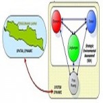
Integration of system dynamic and spatial dynamic in developing Java-Madura-Bali Development Planning Model use waterfall method, generally called as System Development Life Cycle (SDLC) diagram. This diagram is designed to acquire a system to be flexible, adapting and can be develop following new technology trend.

The result is a spatial dynamic model of Java-Madura-Bali Islands as integration of system dynamic and spatial dynamic that show comparing between landuse needs and land allocation based on kinds scenario simulation.

Writer

Ferrari Pinem*, Sigit Purnomo*, Aris Poniman*, Suharto Widjojo*, Mulyanto Darmawan*

Ferrari Pinem*, Sigit Purnomo*, Aris Poniman*,  Suharto Widjojo*, Mulyanto Darmawan*

* National Coordinating Agency for Surveys and Mapping (BAKOSURTANAL)

INDONESIA

Full Research


2

Determine the morphostructure phenomenon, East Khor Al-Zubair by Space Imageries

Dr.TorhanAlmofti *                                         Ahmed Ibrahim Saleh Al-Naemi** Abstract Through the use of satellite data taken by the Landsat satellites a color phenomenon was...
by Lamouchi Helmi
0


1

Detection and monitoring crop of wheat and barley by using NDVI stacking technique and spectral angle mapper algorithm

S K AAl-Hummadi[1] N S Nuaimy[2] A L Ubaidy[3] 1Ministry of science and Technology, ,Remote sensing center, Iraq E-mail: shathamaster@yahoo.com   2Ministry of science and Technology, Remote sensing center, Iraq E-mail: ade...
by Lamouchi Helmi
0


2

Tunisian economy in the face of the Covid-19 pandemic: State of play, analysis and outlook

Bouzayani Rajab [1]/ Abida Zouheir[2] [1] Bouzayani Rajab : Faculty of Economics and Management of Sfax, University of Sfax – Tunisia. E-mail: bouzayanilazher@gmail.com [2] Abida Zouheir : Faculty of Economics and Mana...
by Lamouchi Helmi
0


Thumbnail.8.640.360

Reducing Total Freshwater Use in the Gold Processing Industry Using Linear Programming

Suliman Emdini Gliwan*1 Kevin Crowe *2 *1Ph.D.Candidate, Faculty of Natural Resource Management, Lakehead University, 955 Oliver Rd, Thunder Bay, ON, Canada (P7B5E1). *2Associate Professor, Faculty of Natural Resource Managemen...
by Lamouchi Helmi
0


06-731x413

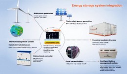
Control of a Hybrid Wind-PV and Energy Storage System

Control of a Hybrid Wind-PV and Energy Storage System Mohammed Al Busaidi, Amer Al-Hinai*, Rashid Al-Abri, Mohammed Al-Badi Electrical & Computer Engineering, Sultan Qaboos University, Oman Abstract—Distributed energy gen...
by Lamouchi Helmi
0


images

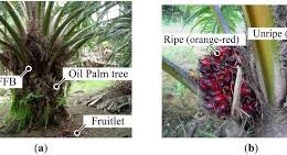
Modeling Ripeness Grading of Palm Oil Fresh Fruit Bunches through Image Processing using Artificial Neural Network

Modeling Ripeness Grading of Palm Oil Fresh Fruit Bunches through Image Processing using Artificial Neural Network Osama M. Ben Saaed1, Meftah Salem M Alfatni1,2*, Abdul Rashid Mohamed Shariff3 and Hadya S Hawedi1 1Faculty of I...
by Lamouchi Helmi
0


maxresdefault

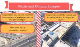
DETECTIONS OF BUILDINGSDIGITAL SURFACE MODELS DEFORMATIONS GENERATED FROM DRONES NADIR IMAGES

  DETECTIONS OF BUILDINGSDIGITAL SURFACE MODELS DEFORMATIONS GENERATED FROM DRONES NADIR IMAGES Jean A. Doumit*, Souhail F. Awad*,Evgeny N. Kiselev** *Lebanese University, Faculty of Letters and Human Sciences, Department of g...
by Lamouchi Helmi
0


Prezentacja programu PowerPoint

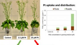
Comparative responses to cadmium toxicity of Arabidopsis thaliana mutant seedling (cad2) and wild type (col0)

Comparative responses to cadmium toxicity of Arabidopsis thaliana mutant seedling (cad2) and wild type (col0) CHAFFEI HAOUARI CHIRAZ1, SLATNI TARAK2, DJEMAL FATMA1, GOUIA HOUDA1 (Company / Faculté des Sciences de Tunis) 1Unive...
by Lamouchi Helmi
0


1320_effects-image

Precision Technologies Role in the Study of Climate Change Impact

The Second session of the International Symposium Precision Technologies Role in the Study of Climate Change Impact and its implications on the Economic and Natural Structure: The reality and suggested solutions Istanbul, Turke...
by Lamouchi Helmi
0


f0ecbd2a-2ed9-458d-91ab-07e1caedea10-9867cc4df536.small

5th International Conference on Water, Energy, Food and Agricultural Technology Istanbul, Turkey, 22-25 January 2019

5th International Conference on Water, Energy, Food and Agricultural Technology Istanbul, Turkey, 22-25 January 2019   Scientific themes 1-      water resources and desertification and agricultural techniques 2-   ...
by Lamouchi Helmi
0


wwwwww

Drone base multiscale Digital Surface Models to planar areas.

Drone base multiscale Digital Surface Models to planar areas. Dr. Jean A. Doumit   Abstract The obtaining of a Digital Surface models (DSMs) at different scales and levels before the appearance of Unmanned Aerial Vehicles (UAV...
by Lamouchi Helmi
0


1

Monitoring of Mosul Reservoir Using Remote Sensing TechniquesFor the Period After ISIS Attack in 9 June 2014

Monitoring of Mosul Reservoir Using Remote Sensing TechniquesFor the Period After ISIS Attack in 9 June 2014 Lecture:  Muthanna Mohammed Abdulhameed AL Bayati University of Technology – Baghdad- Building and Construction Dep...
by Lamouchi Helmi
0


0 comments »


Be the first to comment!


Leave a Reply

Your email address will not be published. Required fields are marked *

*

* Copy This Password *

* Type Or Paste Password Here *

You may use these HTML tags and attributes: <a href="" title=""> <abbr title=""> <acronym title=""> <b> <blockquote cite=""> <cite> <code> <del datetime=""> <em> <i> <q cite=""> <strike> <strong>