About us
Books and letters
Calendar
Contact
Evaluation Committee
Events
Publishing Guide
Reporting Geo-sp
Submit new event
Titles of published researches
English
Français
العربية
Home
About us
Evaluation Committee
Publishing Guide
Research
Interviews
Events
Books and letters
Books
Contact
Blog Archives
Recent
Most Commented
Random
Published Researches
Using gis to create spatial model of some heavy metals in air of Baghdad city
by Ali Neji
0
Full Review »
Published Researches
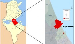
Development of Water Resources in Koya City, Iraq
by Ali Neji
0
Full Review »
Published Researches
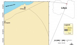
Rainfall and Runoff in the western region of Libya As Climate change Indicators
by Ali Neji
0
Full Review »
Published Researches
STATISTICAL, INVENTORY AND GEOSTATISTICAL STUDIES OF PM10 ATMOSPHERIC AEROSOLS IN THE GULF OF GABÈS, SOUTH TUNISIA
by Ali Neji
0
Full Review »
Published Researches
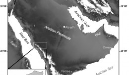
Use of Space Technologies and GIS to Study Groundwater Potential Zones in the Western Coast of the Kingdom of Saudi Arabia
by Ali Neji
0
Full Review »
Published Researches
Soil Salinity Mapping Model Developed Using RS and GIS in Libya
by Ali Neji
0
Full Review »
Published Researches
The Sustainable Groundwater Management in Iran; a Novel and Practical Solution
by Lamouchi Helmi
0
Full Review »
Published Researches
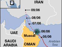
Assessing the Areas Affected by Cyclone Gonu in the Sultanate of Oman Using Remote Sensing
by Ali Neji
0
Full Review »
Published Researches
INVESTIGATION OF SOME HEAVY METALS IN TOW PLANTS OF DRINKING WATER ON BABYLON PROVINCE,IRAQ.
by Ali Neji
0
Full Review »
Page 4 of 7
1
2
3
4
5
6
7
The Latest
News
Articles and Interviews
Reporting Geo-sp
Published Researches
Precision Technologies Role in the Study of Climate Change Impact
5th International Conference on Water, Energy, Food and Agricultural Technology Istanbul, Turkey, 22-25 January 2019
10th edition of the International Congress & technologies dedicated to geospatial applications
Bluesky’s LiDAR experts educate Mouchel’s water industry professionals
Creation of a digital 3-dimensional model
AeroMetric Announces New High Accuracy Mapping Solution
Interview with George Gartner
Measuring earth’s vital magnetic field
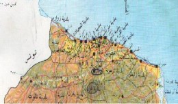
Determine the morphostructure phenomenon, East Khor Al-Zubair by Space Imageries
Detection and monitoring crop of wheat and barley by using NDVI stacking technique and spectral angle mapper algorithm
Tunisian economy in the face of the Covid-19 pandemic: State of play, analysis and outlook
More »
More »
More »
More »
 English
  Français
  العربية