RICHMOND HILL, Ontario, Canada, May 03, 2013 – PCI Geomatics, a world-leading developer of remote sensing and photogrammetric software and systems, announced today that it now supports KOMPSAT-3 imagery within its softwa...
A collaboration protocol was signed on Wednesday morning May 15,2013 inthe Euro-Arab Union of geomatics office inBeirut,Lebanon. The protocol states the technical and scientific cooperation between academics and professionals i...
Although the ultimate goal of the PhoneSat mission was to determine whether a consumer-grade smartphone can be used as the main flight avionics for a satellite in space, the three miniature satellites (named Alexander, Graham a...
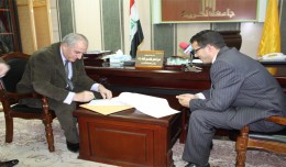
Within the framework of his visit, Dr. Mohamed AYARI, president of the Tunisian Association of Digital Geographic Information and president of the Euro-Arab Union of Geomatics, paid a visit to the University of Takrit where he ...
Drone base multiscale Digital Surface Models to planar areas. Dr. Jean A. Doumit Abstract The obtaining of a Digital Surface models (DSMs) at different scales and levels before the appearance of Unmanned Aerial Vehicles (UAV...
The Tunisian Association of Digital Geographic Information participates in the second scientific congress of desert studies in the Anbar University 24- 26 April 2013, the congress will be held under the slogan “scientific res...
5th International Conference on Water, Energy, Food and Agricultural Technology Istanbul, Turkey, 22-25 January 2019 Scientific themes 1- water resources and desertification and agricultural techniques 2- ...
Bouzayani Rajab [1]/ Abida Zouheir[2] [1] Bouzayani Rajab : Faculty of Economics and Management of Sfax, University of Sfax – Tunisia. E-mail: bouzayanilazher@gmail.com [2] Abida Zouheir : Faculty of Economics and Mana...
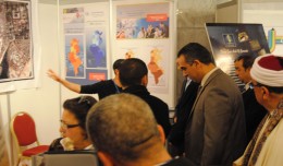
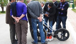
MDS, institution specialized in Georadar technology organized a workshop, within the framework of the 7th edition of Geotunis 8-12 April 2013. The workshop was supervised by Prof. Philippe Xavier, who presented the latest techn...
The second Scientific Congress of the Desert Studies Center: Anabar University/ Iraq December 24 to December 26, 2012 The Desert Studies Center in Iraq organizes the second scientific congress from December 24 to December 26,...
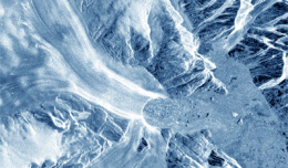
30 November 2012 After two decades of satellite observations, an international team of experts brought together by ESA and NASA has produced the most accurate assessment of ice losses from Antarctica and Greenland to date. This...
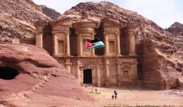
Director General of The Royal Jordanian Geographic center Dr. Dean. Engineer Director General Ouni Hdhawna was chosen as a member of the scientific council of the international congress Geotunis 7thedition which will be held fr...
 English
  Français
  العربية