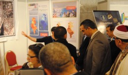
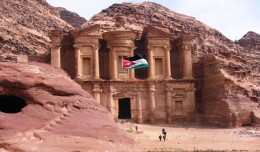
The Tunisian Association of Digital Geographic Information participates in the second scientific congress of desert studies in the Anbar University 24- 26 April 2013, the congress will be held under the slogan “scientific res...
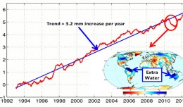
This figure shows changes in global mean sea level as measured by satellite altimetry (NASA/CNES Topex/Poseidon and Jason-1; and NASA/CNES/NOAA/EUMETSAT Jason-2) between 1992 to 2012. The data have been averaged t...
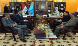
As a respect of his effort aiming at enhancing the scientific exchange at the Arab and international levels, the president of the University of Anbar, Dr kalil Ibrahim, has granted Prof. Mohamed AYARI, president of the Tunisian...
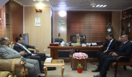
Dr. Mohamed AYARI, president of the Tunisian Association of Digital Geographic Information and president of the Euro-Arab of Geomatics, visited on December 24 and 25 2012 the University of Anbar where he discussed with the pres...
Director General of The Royal Jordanian Geographic center Dr. Dean. Engineer Director General Ouni Hdhawna was chosen as a member of the scientific council of the international congress Geotunis 7thedition which will be held fr...
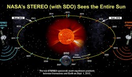
On Nov. 20, 2012, at 7:09 a.m. EST, the sun erupted with a coronal mass ejection or CME. Not to be confused with a solar flare, a CME is a solar phenomenon that can send solar particles into space and can reach Earth one to thr...
Geographic information system (GIS) is a system designed to capture, store, manipulate, analyze, manage, and present all types of geographical data. The acronym GIS is sometimes used for geographical information science or geos...
S K AAl-Hummadi[1] N S Nuaimy[2] A L Ubaidy[3] 1Ministry of science and Technology, ,Remote sensing center, Iraq E-mail: shathamaster@yahoo.com 2Ministry of science and Technology, Remote sensing center, Iraq E-mail: ade...
The Faculty of Earth Sciences Geography and Spatial Configuration, University of Wahran, organized the 4th edition of Algerian Geographic Days on 11/12 December 2012. A number of academics, researchers, and amateurs in the fi...
The President of the Tunisian Association of Digital Geographic Information, Mr. Mohamed AYARI with a delegation from the Association visited Algeria from December 09 to December 15, 2012. The travel included a visit to a numbe...
5th International Conference on Water Resources and Arid Environments 7-9 January 2013 Organizers: Prince Sultan Bin Abdulaziz International Prize for Water (PSIPW) King Saud University, represented by the Prince Sultan Institu...
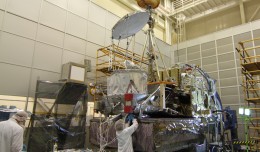
NASA’s Global Precipitation Measurement (GPM) Core Observatory satellite went through its first complete comprehensive performance test (CPT), beginning on Oct. 4, 2012 at NASA’s Goddard ...
 English
  Français
  العربية