Information Technology Infrastructure Library ITIL Oldo-lina Foundation for the French East development in collaboration with the Euro-Arab union Geomatics organizes training for IT Service Management ITIL V3 Will be held in Ly...
The President of the Tunisian Association of Digital Geographic Information, Mr. Mohamed AYARI with a delegation from the Association visited Algeria from December 09 to December 15, 2012. The travel included a visit to a numbe...
The editing committee of GeoSP has interviewed Mr. George Gartner president of ICA and the international academic researcher about the role of ICA in supporting scientific research and young researchers. Mr. Gartner expressed a...
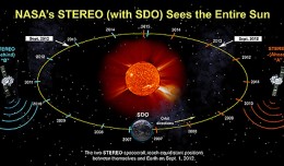
On Nov. 20, 2012, at 7:09 a.m. EST, the sun erupted with a coronal mass ejection or CME. Not to be confused with a solar flare, a CME is a solar phenomenon that can send solar particles into space and can reach Earth one to thr...
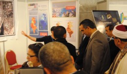
Dr. Monji Marzouk, Minister of communication and Information Technologies opened on Monday, April 8 2013 the activities of the 7th edition of the international congress geotunis held under the slogan: Through geographic infrast...
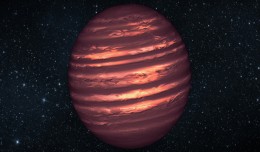
PASADENA, Calif. — Astronomers using NASA’s Spitzer and Hubble space telescopes have probed the stormy atmosphere of a brown dwarf, creating the most detailed “weather map” yet for this class of cool, st...
Drone base multiscale Digital Surface Models to planar areas. Dr. Jean A. Doumit Abstract The obtaining of a Digital Surface models (DSMs) at different scales and levels before the appearance of Unmanned Aerial Vehicles (UAV...
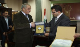
Regarding his efforts in promoting the scientific cooperation between institutions at the Arab and International levels and the use of Geomatics technology, the president of the University of Takrit, Dr. Mzahem Kacem Alkaiat, g...
The Tunisian Association of Digital Geographic Information participates in the second scientific congress of desert studies in the Anbar University 24- 26 April 2013, the congress will be held under the slogan “scientific res...
Geographic information system (GIS) is a system designed to capture, store, manipulate, analyze, manage, and present all types of geographical data. The acronym GIS is sometimes used for geographical information science or geos...
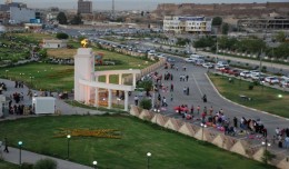
Dr. Mohamed AYARI, president of the Tunisian Association of Digital Geographic Information and president of the Euro-Arab Union of Geomatics visited Kurdistan on December 27 2012 where he met the president of the Association of...
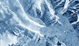
30 November 2012 After two decades of satellite observations, an international team of experts brought together by ESA and NASA has produced the most accurate assessment of ice losses from Antarctica and Greenland to date. This...
 English
  Français
  العربية