Abstract
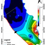
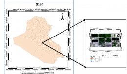
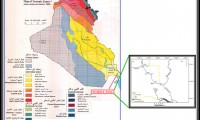
The current study includes applying the vertical electric sounding by using the symmetrical Schlumberger configuration in the area which located between Baiji and Tikrit to the West of Tigris river, between longitudes (43° 40′ 12.3”) and (43° 56′ 22.6”) and latitudes (34° 35′ 13.3”) and (34° 54′ 41.7”), with total area of approximately (700 km2), in order to identify the thickness and the expansion of the aquifers, then to delineate and evaluate their hydraulic characters.
This study adopted the measurements of apparent resistivity measured in 40 VES points in the area. VES points were distributed along 6 geoelectric traverses in order to obtain a possible coverage of the studied area. The spreading of current electrodes (AB/2) reached a distance up to (400 m), and a distance of (40 m) was reached for the spreading of voltage electrodes (MN/2); thus, a depth penetration of (151 m) was obtained.
Apparent resistivity measurements were drawn, and their deformations, which resulted from smoothing, were treated. Field curves of VES points were interpreted qualitatively by three procedures to obtain a primary idea about the number of the electrical zones and the depths of the separating surfaces between them, and to map the vertical and horizontal change locations in the apparent resistivity values. Then the curves were interpreted quantitatively manually by Auxiliary point method and Ebret method to find out the values of quantitative resistivity and thickness of the electrical zones. After that, the sounding curves were interpreted automatically by the computer program (IPI2win) applying the Inverse manual interpretation method to scrutinize the manual interpretation results and enhance their accuracy if it might be few of their parts by manual interpretation.
The program (IPI2win) results of interpretation were used to draw (6) Geoelectrical sections along the survey traverses, then they were transferred to geological sections by achieving the proper smoothing, after the matching of the electric zones limits gained from the interpretation process results with the limits of the layers which were penetrated by the drilled wells in the area of study with regard to the effect of the two principle of equivalence and suppression. Likewise, the results of the interpretation showed that the thickness of the main aquifer of the area is from (50-128 m) and consists of sediments (sand, clay sand and clay) which belongs to the Injana formation, whose conditions are apt to change in the area, from the confined type to the semi confined, depending on the confining clay layer thickness which bound the aquifer from the top part, and the extent of being affected by folding. A gravel layer belong to Quaternary sediments mounts the aquifer in middle and south of the study area; a part of this layer is within the water saturated zone in the southern part of the study area, which made in this area a sub-aquifer of the unconfined type with a thickness of about (5-25 m). Moreover, the geoelectrical sections showed the existence of a high-conductivity layer bounds the aquifer from beneath and was considered as a layer of claystone saturated with salt-water.
Many empirical relations have been put between the geoelectrical parameters, and the Hydraulic parameters by which a Geophysical model was suggested for the aquifer which is supposed to have a constant thickness and varying resistivity and hydraulic conductivity. These relationships have given several mathematical equations, some of them were used to calculate the hydraulic parameters represented by (Hydraulic conductivity and Transmissivity) at the electric VES points where no experimental pumping wells were available. These values were used to draw the two maps of the hydraulic conductivity and the transmissivity for the aquifer. These two maps displayed sites where hydraulic parameters for the aquifer and the areas of low hydraulic parameters rise, so it became possible to new wells locations with high discharge.
Writer

Dr. Sabbar Abdullah Salih
1. Personal Information
Surname: Al-Kaisy Name: Sabbar Abdullah Salih
Place of birth: Baiji – Salahiddin
Date of Birth: 1-7-1965
Marital Status: married
Number of Children: 5
Iraq- Tikrit- Al-Qadisiyyah-University Village- Home No.71
2. Academic Information
B.Sc. In Geology, University of Salahiddin, College of Science, Department of Geology, 1987.
M.Sc. in Hydrology University of Baghdad, College of Science, Department of Geology, 1992.
M.Sc. Thesis “Hydrogeological Conditions of Ajil Sub-Basin North of Iraq.”
Ph.D. in geology/ hydrogeology, University of Baghdad, College of Science, Department of Geology, 2001
Ph.D. Thesis ”Evaluation of the problem of cavities and weak zones below the industrial establishments in Baiji area- Iraq
3. Occupations
1- Head Researcher in remote sensing research unit, College of Science / University of Tikrit. 2005-2009.
2- Assist. Lecturer - Department of Civil Engineering / College of Engineering / University of Tikrit. 1993-1996.
3- Lecturer - Department of Civil Engineering / College of Engineering /University of Tikrit. 1996 - 1999.
4- Assist. Professor - Department of Computer Sciences, College of Science / University of Tikrit. 1999-2003.
5- Assist. Professor -Department of Applied Geology Sciences College of Science University of Tikrit 2002-2007
6- Professor -Department of Applied Geology Sciences College of Science University of Tikrit 2008-
7- The head manager of computer center/ University of Tikrit 1994-1999.
8- The head manager of printing house/ University of Tikrit 2002-2003.
9- Dean assistant- College of Science- University of Tikrit, 2003.
10- Secretary Editor, Tikrit Journal of Pure Science, University of Tikrit, 2002- 2009.
11- The head manager of computer and information center/ University of Tikrit 2006.
12- Dean assistant- College of Science- University of Tikrit, 2007.
13- The head manager of remote sensing research unit / University of Tikrit 2007-2008.
14- The head manager of computer and information center / University of Tikrit 2008.
15- The head manager of Natural Resources Research Center / University of Tikrit 2009-2011.
4.Consoltations
1- Consultant of Baiji Refineries Company.
2- Consultant of Northern Fertilizers Company.
3- Consultant of Baiji Power Plant.
4- Consultant of the Iraqi Company of Railway lines.
5- Member of discussions committees for M.Sc. and Ph.D., in Iraqi Universities.
6- Consultant of groundwater wells drilling company.
7- Consultant of general company of geological survey and mining.
8- Head of field training committee for 4th class of undergraduate, department of applied geology, college of science, university of Tikrit, 2005, 2006, 2007, 2008, 2009, 2010, 2011.
5. Professional Affiliations:
1- Member, Iraqi Geological Union.
2- Member, Scientific union of water resources, Iraq
3- Member of preparation committee of 1st, 2nd, 3rd and 4th of Al- Quds International conferences, University of Tikrit.
4- Member of preparation committee of 1st, 2nd and 3rd Symposiums of remote sensing unit, University of Tikrit.
5- Member of preparation committee of 1st, 2nd,3rd and 4th Symposiums of Department of geology, University of Tikrit.
6- Member of the committee to development of Laboratories in the ministry of Higher Education, 2001-2003.
7- More than 60 Scientific Committee in University of Tikrit, and other Universities.
8- Evaluation of 8 Ph.D. and M.Sc. Thesis, for graduated Student in University of Tikrit and other Universities.
9- Evaluation of more than 50 researches for publishing in Iraqi Scientific Journals.
10- Supervisor of 15 B. Sc., and M. Sc. Student.
11- Member of preparation committee of 1st Scientific Symposium, department of Geology, college of science, University of Tikrit, 2004.
12- Member of preparation committee of 2nd Scientific Symposium, college of science, department of Geology, University of Tikrit, 2005.
13- Head of preparation committee of 1st Scientific Symposium, remote sensing Unit, college of science, University of Tikrit, 2006.
14- Head of preparation committees of 2st Scientific Symposium, remote sensing Unit, college of science, University of Tikrit, 2007.
15- Member of preparation committee of 3rd Scientific Symposium, remote sensing Unit, college of science, University of Tikrit, 2008.
16- Member of preparation committee of construction Symposiums of University of Tikrit, 14 April, 2009.
17- Member of preparation committee of 1st Scientific conference, college of science, University of Tikrit, 29 Sep. 2009.
18- Member of administration board of natural resources research center, University of Tikrit,, 2009-
19- Member of consultation board of scientific journal, University of Kirkuk.
20- Member of consultation board of Journal of Groundwater, Ministry of Water Resources.
6. List of Researches done by Dr. Sabbar Abdullah Salih
1- Groundwater, Resources, levels and types in Baiji City, Iraqi Journal for Science, 1996, Vol. 27, No2.
2- Water Availability periods and water surplus in Ajil sub-basin, North of Iraq. Tikrit Journal for Engineering Science, 1996, Vol. 3, No 2.
3- Using of groundwater for Irrigation by drip Irrigation system –field study in North of Iraq, Tikrit Journal for Engineering Science, 1999, Vol. 6, No 3.
4- Suggested system to treat the pollution in Al-Naft Valley in Kirkuk –North of Iraq. Tikrit Journal for Engineering Science, 1998, Vol. 5, No 1.
5- Suggested system to drain ground water and draw down its levels in Baiji City, Tikrit Journal for Engineering Science, 1995, Vol. 2, No 2.
6- The environmental effect of H2S Gases in Al-Fatha Springs and their treatment. Tikrit Journal for Engineering Science, 1998, Vol 5, No 3.
7- Ground Water Hydrology Of Ajil Sub-basin, North of Iraq, Iraqi Journal for Science, 1995, Vol. 36, no 5.
8- Rising of ground water level in Baiji Refineries Company, the problem and treatment. Tikrit Journal for Engineering Science, 1999, Vol. 6, No 5.
9- Microgravity method to detection of weak zones under the foundations of building site – Case study in Iraq, Journal of Dirasat, Jordanian University, 2002, Vol. 30, No,2.
10- Pollution of ground water in the sites of industrial establishments by the trace elements – Case study in north Iraq, Proceeding of the first Scientific Conference in the College of Education, University of Tikrit, 18 march 2003, Iraq.
11- A new interpretation to the tectonic zones of the southern Iraq, Tikrit Journal for Engineering Science, 2001, Vol 7, No 5.
12- Hydrochemistry of Springs Water in Al-Khalifah Salttern -North of Iraq and Optimum Method to Produce the Salt, Tikrit Journal for Pure Science, 2002, Vol 8, No 1.
13- Groundwater saturation indices for evaluation of foundations soil problems – case study at Baiji Sub-Basin / Iraq, Tikrit Journal for Engineering Science, 2002, Vol 9, No 1.
14- Effect of waste water on the soil behavior and contamination, proceeding of the first Scientific Conference in the College of Education, University of Tikrit, 18 March 2003, Iraq.
15- Suggested Grout Materials and Grouting Pressure for Treatment of Weak Zones and Cavities under the Foundations of Baiji Fertilizers Company, Under Publishing.
16- Using of Ground Water to Reduce the Problem of Cavitation Under the Foundations in Gypsiferos soil in the Site of Tikrit University-North Iraq, Tikrit Journal for Pure Science Vol.9, No.1-2003.
17- Influence of industrial wastewater of the fertilizing company on the behaviour of the soil of wastewater platforms, Baiji area, Tikrit Journal for Pure Science Vol.9 No.2-2003.
18- Prediction of the Problem of Cavities Under the Buildings by the Activity of Water and Soil Chemistry in Selected site of Tikrit City- North Iraq, proceeding of 6th International Conference on Geochemistry, Alexandria University, Alexandria, Egypt, 15-16 Sept.-2004, pages 31-41.
19- Determination of the Locations of Ground Water Table Anomalies by the Ring and Central Point Method Study of Three Areas in Iraq, Al- Rafidain Journal for science, University of Mosul, Vol. 16, No. 1, 2005.
20- Investment of water bodies for tourism attraction, case study in Makhul dam reservoir, north Iraq, Tikrit journal for humanities, Vol. 12, No. 1, P. 142-153.
21- Who Did What To The Mesopotamian Marshes? Inferences From Temporal Satellite Data, Geological Society Of America Annual Meeting Abstracts With Programs, Vol. 37, No.7, P. 510.
22- Using of Gradient Techniques for Depth Estimation of Gravity Source, Tikrit Journal for Pure Science Vol.11 No.1-2006.
23- Applications of Ground Penetrating Radar (GPR) in Detection of Behavior of Groundwater Table near Pumping Well, Tikrit Journal for Pure Science Vol.12. No.1-2007.
24- Hydrologic impacts of engineering projects on the Tigris–Euphrates system and its marshlands, Journal of Hydrology (2008) 353, 59– 75.
25- Study of nature, origin, movement and extension of sand dunes by using sedimentological aspects and remote sensing techniques in Baiji area, North Iraq, Kirkuk Journal for Science, Vol. 2., no. 1, 2009.
26- Mineralogy and Geochemistry of Meha Solar Salt Pond, Iraq, Proceedings of the 2nd International Conference on the Ecological Importance of Solar Saltworks (CEISSA2009), Merida, Yucatan, Mexico, 26 – 29 March 2009.
27- Geochemistry of salt-affected wasteland resulting from long-term wastewater irrigation, proceeding of 2nd workshop, Productive and Sustainable Use of Saline Waters and Salt-affected Soils in Agriculture, ICARDA Headquarters, Aleppo, Syria, 15-18 November 2009, 65-72.
28- Hydrogeological conditions of western Makhol sub-basin, north Baije Iraq, 1st scientific conference of desert studies center, University of Anbar, Anbar, Iraq, 15 Dec. 2009.
29- Soil Contamination by Heavy Metals in Floodplain of Qweik River, Aleppo, Syria, Tikrit Journal for Pure Science Vol.15. No.2-2010.
30- Morphometric, Hydrogeologic and Hydrochemical system of Mehha Salt depression In Sharqat, South of Mosul City, Iraq, The Journal of desert research center, University of Anbar, 2010. (Under Press).
31- Using of microgravity method for the detection of cavities and week zones under the foundations of Dijlah hospital, Tikrit, Tikrit Journal for Pure Science, 2010 (under press).
32- Hydrochemistry as indicator to select the suitable locations for water storage in Tharthar Valley, Al-Jazira area, Iraq, Proceeding of International Conference on “Sustainable Water Management” (SWM 2010), 15 to 17 September 2010, Mehran University of Engineering and Technology Jamshoro, Sindh, Pakistan.
33- Evaluation of Efficiency of Samarra Dam Reservoir on Tigris River, Midst of Iraq, 7th International Symposium on the Eastern Mediterranean Geology, 18–22 October, 2010, Çukurova University, Adana – Turkey, P-176.
34- Using of GIS spatial analyses to study the geometry of selected location for dam reservoir on Wadi Al-Jirnaf, west of Shirqat Area, Iraq, 5th International Congress Geotunis 2010, The Tunisian Association of Digital Geographic Information, 29 November to 03 December 2010, Tunis.
35- Determination of groundwater recharge by the water balance zones of Baiji – Tikrit sub-basin, north of Iraq, Kirkuk Journal for Science, Vol. 1., no. 2, 2011.
7. Participation in Scientific Conferences:
1- 10th Geological Conference in the Iraqi Geologists Syndicate –Baghdad –Iraq-1992.
2- 1st Scientific Conference Held in the college of engineering, University of Tikrit-1994.
3- 11th Geological Conference in the Iraqi Geologists Syndicate –Baghdad –Iraq-1994.
4- 12th Geological Conference in the Iraqi Geologists Syndicate –Baghdad –Iraq-1996.
5- 2nd Scientific Conference Held in the college of engineering, University of Tikrit-1996.
6- 3rd Scientific Conference Held in the college of engineering, University of Tikrit-1998.
7- 13th Geological Conference in the Iraqi Geologists Syndicate –Baghdad –Iraq-1998.
8- 1st Scientific Conference held in the Iraqi Engineering Syndicate Branch of Salahaddin, Tikrit –Iraq- 1998.
9- 1st scientific symposium of state company for fertilizers in northern area, Baiji, Iraq, 1999.
10- 2nd Conference of Society of water resources held in Ministry of Irrigation -Baghdad-Iraq-2000.
11- 7th Jordanian Geological Conference, Jordanian University, Amman-2001.
12- 4th Syrian -Egyptian Conference of Chemical and Petroleum Engineering, Al-Baath University, Syria-2001.
13- 6th International Conference on Geology of the Arab World, Cairo University, Egypt-2002.
14- 4th international conference for role of engineering toward a better environment – Alexandria University –2002.
15- 1st Symposium about the desertification in Iraq, University of Tikrit, College of Agricultural, 2002.
16- 15th Geological Conference in the Iraqi Geologists Syndicate –Baghdad –Iraq-2002.
17- 4th Scientific Conference Held in the college of Education, University of Tikrit-2003.
18- A joint United States/ Egyptian workshop, to identify water resources / environment related research needs/ focus on: using of remote sensing technology for assessing and managing surface and ground water. 3-9 Dec. 2003 Cairo, Egypt.
19- 7th Jordanian Geological Conference, Jordanian University, Amman-2004.
20- 7th International Conference on Geology of the Arab World, Cairo University, Egypt-2004.
21- 1st symposium of Department of Geology, College of Science, University of Tikrit, 2004, Tikrit, Iraq.
22- 6th International Conference on Geochemistry, Alexandria University, Alexandria-2004.
23- Conference on Advanced Remote Sensing for Earth Observation; Systems, Techniques, and Applications, Riyadh, Kingdom of Saudi Arabia, May 8-11, 2005
24- Int. Conference & Field Seminar - Water Resources & Environmental Problems in Karst, CVIJIĆ, Belgrade, Serbia and Montenegro, 2005.
25- Research Program, Center of Northeast Asian Studies, University of Tohoko, Sendai, Japan, 2006.
26- 2nd symposium of Department of Geology, College of Science, University of Tikrit, March 2006, Tikrit, Iraq.
27- 1st symposium of remote sensing unit, College of Science, University of Tikrit, 5 Dec. 2006, Tikrit, Iraq.
28- 15th International Symposium and Exhibition on Remote Sensing and Assisting Systems, General Organization of Remote Sensing, Damascus- Syria, 18-21 September 2006.
29- 8th Jordanian Geological Conference, Amman-2007.
30- 2nd symposium of remote sensing unit, College of Science, University of Tikrit, 19 may 2007, Tikrit, Iraq.
31- 3rd symposium of remote sensing unit, College of Science, University of Tikrit, 26 march 2008, Tikrit, Iraq.
32- 4th symposium of Department of Geology, College of Science, University of Tikrit, Nov, 2008, Tikrit, Iraq.
33- The 5th Congress of Scientific Research Outlook in the Arab World, “Scientific Innovation and Sustained Development” 25 - 30 October 2008, Fez-Morocco.
34- 1st Symposiums of construction of University of Tikrit, 14 April, 2009.
35- 1st Scientific Conference Held in the college of Science, University of Kirkuk- Feb. 2009.
36- 4th symposium of remote sensing unit, College of Science, University of Tikrit, May, 2009, Tikrit, Iraq.
37- 1st Scientific Conference Held in the college of Science, University of Tikrit, 29 Sep. 2009.
38- 2nd workshop, Productive and Sustainable Use of Saline Waters and Salt-affected Soils in Agriculture, 15-18 November 2009, ICARDA Headquarters, Aleppo, Syria.
39- 1st Scientific Conference Held in the Desert Studies Center, University of Anbar, 15 Dec. 2009.
40- Advanced Training Course in RS & GIS, INTER-ISLAMIC NETWORK ON SPACE SCIENCES & TECHNOLOGY, (ISNET), 05-18 April 2010, Karachi, Pakistan.
41- International Conference on “Sustainable Water Management” (SWM 2010), 15 to 17 September 2010, Mehran University of Engineering and Technology Jamshoro, Sindh, Pakistan.
42- 7th International Symposium on the Eastern Mediterranean Geology, 18–22 October, Çukurova University, Adana – Turkey.
43- 5th International Congress Geotunis 2010, The Tunisian Association of Digital Geographic Information, 29 November to 03 December 2010, Tunis.
44- 2nd Scientific Conference Held in the Desert Studies Center, University of Anbar, May. 2011.
45- 6th symposium of Department of Geology, College of Science, University of Tikrit, 22 May, 2011, Tikrit, Iraq.
8. Subjects Taught to Students:
1- Supervisor on 8 M. Sc. and 2 Ph. D. Student in Tikrit University.
2- Groundwater Hydrology
3- Engineering Hydrology
4- Hydrochemisry
5- Applications of Geographic Information Systems (GIS) in Hydrogeology
6- Applications of Remote Sensing (RS) in Hydrogeology
7- Dams and Reservoirs
8- Geological Software
9- Computer Programming for geological application
10- Computer Applications
11- Geochemistry
12- General Geology
13- Hydrogeology of Iraq (M. Sc. course).
14- Advance Hydrogeology (M. Sc. course).
15- Programming of remote sensing (M. Sc. course).
16- field training course for 4th class (2005-2001)
9. Research Projects
1- C. Jones, M. Sultan, E. Yan, A. Milewski, M. Hussein, A. Al-Dousari, S. A. Salih, R. Becker, Who did what to the Tigris-Euphrates System? Inferences from Hydrologic Models and Remote Sensing Data, granted by the National Science Foundation (NSF).
2- Salih, S.A, & Al-Juboury, A. A, Al-Tarif, A.M., & Eleiwi, J.H. (2007), Geoengineering Studies to the site of Dam and Reservoir in Wadi Al-Jirnaf – West of Shirqat, Iraq, granted by the Arab Science and Technology Foundation (ASTF).
3- Al-Juboury, A. A, Al-Tarif, A.M., Salih, S.A. & Eleiwi, J.H. (2007), Development of Saline Lakes in Sharqat area, south of Mosul City, granted by the Arab Science and Technology Foundation (ASTF), grant No WA06-2007
4- Salih,Sabbar Abdallah and Kadem, Lifta Salman, Hydrology of Surface and Groundwater in Tharthar Intermittent Valley, and Geochemistry of Surrounding Gypsiferous Soil, to Refresh the Agriculture in Northern Part of Al- Jazira area, Iraq., Granted By Norman E. Borlaug International Agricultural Science and Technology Fellows Program (2009).
10. Studies
1- Treatment of the drainage system of wastewater and ground water rising in Baiji City, 1997.
2- Evolution of geophysical studies for detection of locations, depths and shapes of cavities under the foundations of Baiji Fertilizer Company, 1998.
3- Treatment of cavities by grouting under the Foundations of Buildings in Baiji Power Plant, 1998.
4- Treatment of cavities by grouting under the Foundations of Buildings in Baiji Fertilizers Company, 1999.
5- Treatment of cavities by grouting under the Foundations of Buildings in Baiji refineries, 1999.
6- Treatment of the movement of Baiji Sand Dunes along the railway lines of Baiji by using of industrial drainage system, 2000.
7- Evaluation the usability of limestone for railway lines covering, between Tikrit and Mosul, in seven quarries in Salahaddin province, 2001.
8- Study to establish the general company of geological Survey and Mining, Salahaddin Province, 2006.
9- Study to establish the Natural Resources and Environment Researches Center, University of Tikrit, 2007.
10- Study of Construction of Bricks Factories in Salahaddin Governorate, 2007.
11- Study of Construction of Grey Cement Factory in Salahaddin Governorate, 2007.
12- Study of Construction of Table Salt Factory in Salahaddin Governorate, 2007.
13- Study of the Natural Resources in Salahaddin governorate 2007.
14- Using of Jatropha curcas to stabilization of soil and preservation of desertification, 2009
15- Detection of cavities under the foundations Dijla hospital by microgravity method, Tikrit, March, 2009.
16- Hydrogeology of Baiji – Tikrit sub- basin, general board of groundwater, ministry of water resources, Iraq.
17- Biological diversity in water environments in Iraq, Ministry of environment, 2011, Iraq.
11. International Collaboration in Scientific Research
1- Department of Geosciences, University of Western Michigan
2- National Science Foundation (NSF), USA.
3- Matsumae International Foundation (MIF), Japan.
4- Center of Northeast Asian Studies, University of Tohoko, Sendai, Japan.
5- Arab Science and Technology Foundation (ASTF).
6- USDA/ Borlaug Science and Technology Fellows Program.
7- International Center of Arid Regions and Desert Areas (ICARDA)
8- Inter-Islamic network on space sciences & technology (ISNET), SUPARCO, Pakistan.
12. Acknowledgements
1- More than 150 Acknowledgement certificates from the dean and president of University, Minister of Higher Education and scientific research.
13. Annual evaluation
Excellent for 15 year, (1993-2011).
Prize of the Ministry of Higher Education for excellent teaching staff, 2000.
1st professor of University of Tikrit, 2011
 English
  Français
  العربية


