6 November 2012

Atmospheric PM10 pollution in the mining basin of Gafsa (south-western of Tunisia): statistical analysis and cartography

Abstract

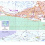
location of sampling sites

The distribution and diffusion of particulate Matter (PM10) throughout phosphates mining areas cause deterioration of the environment and quality of life. It affects human health, ecosystem and climate. Mining activities can lead to land degradation, changes in topography, soil and atmospheric pollution. Contaminants originating from phosphates mines can be transported to long distance. It is essential to assess the spatial distribution of air quality and its effects on the health of human. To satisfy the above –mentioned needs, the generally accepted suggestion presented in this work is to use a geographic information system (Gis) as management tool for air pollution control .This paper aims to present the cartography of dust (PM10) at phosphate mine site. Passive monitoring or sampling is used to determine the pollutant distribution over a large area, and to assess integrated concentration levels over long periods of time. This methodology can be used to determine areas of maximum concentration and can be combined with the use of a mobile laboratory. The study of level of PM10 by active monitoring shows that PM10 daily average concentration exceeds frequently the EU (European Union)  air quality and WHO (World Health Organization) standard limit (50 µg/m3) in urban and industrial area.

PM10 daily passive samples collected in 18 sites (A1, A2, A3, A4 ,A5, A6 ,B1, B2, B3, B4,B5, B6 ,C1 C2, C3, C4, C5 ,C6 )show that only some sites are in compliance with daily average of (50 µg/m3) and World Health Organization standard limits . For annual concentration there are not exceedances of the 40 µg/m3 European Union air quality standard limits recorded in all station

Writer
Raja MOHAMEDa*, A. BEN BRAHIM a, Dalila TAIEB a

  • Nom et prénom:                                        Mohamed Raja
  • Date et lieu de naissance:                        29/06/1984 Gafsa
  • Nationalité:                                              Tunisienne
  • Les diplômes obtenus :
    •  2003 : Baccalauréat Sciences Expérimentale : mention(Bien)
  •  2008: Diplôme de Maîtrise Sciences Physique
  •  2009 : Diplôme de mastère en chimie industrielle et environnement : mention très bien, major de promotion
  •  2010 : inscription 1ére thèse de doctorat spécialité génie chimique de procédé
  •  2011 : inscription 2ére thèse de doctorat spécialité génie chimique de procédé
    • Stages :
    •  Stage de recherche durant 4 mois au sein de laboratoire département système énergétique et environnement école de Mine de Nantes.
Ses travaux de recherche ont porté sur l’étude, la caractérisation et la mise au point d’un combustible innovant élaboré à partir des huiles de graissage usagées.
  •  Stage de recherche durant 6 mois au sein de centre de recherche Metlaoui .
Ses travaux de recherche ont porté sur l’analyse qualitative de poussière

Full Research


2

Determine the morphostructure phenomenon, East Khor Al-Zubair by Space Imageries

Dr.TorhanAlmofti *                                         Ahmed Ibrahim Saleh Al-Naemi** Abstract Through the use of satellite data taken by the Landsat satellites a color phenomenon was...
by Lamouchi Helmi
0


1

Detection and monitoring crop of wheat and barley by using NDVI stacking technique and spectral angle mapper algorithm

S K AAl-Hummadi[1] N S Nuaimy[2] A L Ubaidy[3] 1Ministry of science and Technology, ,Remote sensing center, Iraq E-mail: shathamaster@yahoo.com   2Ministry of science and Technology, Remote sensing center, Iraq E-mail: ade...
by Lamouchi Helmi
0


2

Tunisian economy in the face of the Covid-19 pandemic: State of play, analysis and outlook

Bouzayani Rajab [1]/ Abida Zouheir[2] [1] Bouzayani Rajab : Faculty of Economics and Management of Sfax, University of Sfax – Tunisia. E-mail: bouzayanilazher@gmail.com [2] Abida Zouheir : Faculty of Economics and Mana...
by Lamouchi Helmi
0


Thumbnail.8.640.360

Reducing Total Freshwater Use in the Gold Processing Industry Using Linear Programming

Suliman Emdini Gliwan*1 Kevin Crowe *2 *1Ph.D.Candidate, Faculty of Natural Resource Management, Lakehead University, 955 Oliver Rd, Thunder Bay, ON, Canada (P7B5E1). *2Associate Professor, Faculty of Natural Resource Managemen...
by Lamouchi Helmi
0


06-731x413

Control of a Hybrid Wind-PV and Energy Storage System

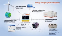
Control of a Hybrid Wind-PV and Energy Storage System Mohammed Al Busaidi, Amer Al-Hinai*, Rashid Al-Abri, Mohammed Al-Badi Electrical & Computer Engineering, Sultan Qaboos University, Oman Abstract—Distributed energy gen...
by Lamouchi Helmi
0


images

Modeling Ripeness Grading of Palm Oil Fresh Fruit Bunches through Image Processing using Artificial Neural Network

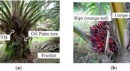
Modeling Ripeness Grading of Palm Oil Fresh Fruit Bunches through Image Processing using Artificial Neural Network Osama M. Ben Saaed1, Meftah Salem M Alfatni1,2*, Abdul Rashid Mohamed Shariff3 and Hadya S Hawedi1 1Faculty of I...
by Lamouchi Helmi
0


maxresdefault

DETECTIONS OF BUILDINGSDIGITAL SURFACE MODELS DEFORMATIONS GENERATED FROM DRONES NADIR IMAGES

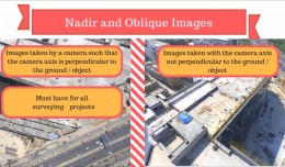
  DETECTIONS OF BUILDINGSDIGITAL SURFACE MODELS DEFORMATIONS GENERATED FROM DRONES NADIR IMAGES Jean A. Doumit*, Souhail F. Awad*,Evgeny N. Kiselev** *Lebanese University, Faculty of Letters and Human Sciences, Department of g...
by Lamouchi Helmi
0


Prezentacja programu PowerPoint

Comparative responses to cadmium toxicity of Arabidopsis thaliana mutant seedling (cad2) and wild type (col0)

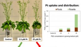
Comparative responses to cadmium toxicity of Arabidopsis thaliana mutant seedling (cad2) and wild type (col0) CHAFFEI HAOUARI CHIRAZ1, SLATNI TARAK2, DJEMAL FATMA1, GOUIA HOUDA1 (Company / Faculté des Sciences de Tunis) 1Unive...
by Lamouchi Helmi
0


wwwwww

Drone base multiscale Digital Surface Models to planar areas.

Drone base multiscale Digital Surface Models to planar areas. Dr. Jean A. Doumit   Abstract The obtaining of a Digital Surface models (DSMs) at different scales and levels before the appearance of Unmanned Aerial Vehicles (UAV...
by Lamouchi Helmi
0


1

Monitoring of Mosul Reservoir Using Remote Sensing TechniquesFor the Period After ISIS Attack in 9 June 2014

Monitoring of Mosul Reservoir Using Remote Sensing TechniquesFor the Period After ISIS Attack in 9 June 2014 Lecture:  Muthanna Mohammed Abdulhameed AL Bayati University of Technology – Baghdad- Building and Construction Dep...
by Lamouchi Helmi
0


bbbbbb

TOOLS FOR A NEW URBAN AGENDA

  Tullia Valeria Di Giacomo (*); F. Paolo Di Giacomo (**) (*)Alpha Consult, Rome; (**) SOGEIT, Tunis   Keywords: GIS, WEBGIS, Urban Agenda, sustainable development Summary: Urban Authorities, civil society, businesses and kno...
by Lamouchi Helmi
0


0 comments »


Be the first to comment!


Leave a Reply

Your email address will not be published. Required fields are marked *

*

* Copy This Password *

* Type Or Paste Password Here *

You may use these HTML tags and attributes: <a href="" title=""> <abbr title=""> <acronym title=""> <b> <blockquote cite=""> <cite> <code> <del datetime=""> <em> <i> <q cite=""> <strike> <strong>