12 July 2013

Challenges and Opportunities of Using Integrated Data Viewer for Disaster Mitigation in Non Space Faring Countries of the Less Developed World: IAA – IGMASS Projects in Africa.

Abstract

Sans titre

The International Academy of Astronautics (IAA) and the Russian Academy of Cosmonautics (RACTs) has successfully started the practical implementation of a wide – scaled project, with the creation of the International Global Monitoring Aerospace System (IGMASS) – the system for efficient and sufficient forecasting of destructive ecological disasters, natural disasters, and manmade catastrophes on the basis of combining all available monitoring information from the Earths ionosphere, atmosphere, lithosphere and outer space. It will unify all monitoring potentials (space, air, and ground), facilities in member states and organizations/institutions in Africa and globally to forecast such dangerous and high costly events in Africa and beyond. The international committee on the IGMASS product implementation is a collective executive body which is functioning under the aegis and framework if IAA and RACTs, with the purpose of drawing a wide public attention to the IGMASS project both in the countries participants and on the international level: profile scientists and experts from all over the world; consolidation, searching new ideas and technical decisions in the field of forecasting natural and manmade emergency situations/ early warning. The requirement for a steady sustainable development of world community without risk depends on reliable and timely information for early warning. The use of space technology with its various applications offers a unique perspective of the earth, its resources and human impact upon it. Africa is in a cross road and find itself in a dilemma in an attempt to increase and better its developmental path. Satellite data receiving center stationed in Africa would be the heart of developmental initiatives in the continent if allow to operate continuously at a high level for a long time and provide all concern sectors of African satellite images and products on the basis that allow an  increase in the growth potential of the African region in a whole. The usage of ERS data from space will provide the possibility of obtaining up-to-date and objective information about the underlying surface, natural and manmade objects, environment, emergencies and natural phenomenon. Recognizing the significant role of space technology for the attainment of rapid sustainable socio-economical development, Africa need to have or share their knowledge and space assets to the needy in order and close up the digital gap. Space application can be the best alternative to reduce vulnerability and risk that is retarding sustainable development in Africa. In response to the growing needs of developing countries, Space application will stimulate the development of new technologies that are the major keys to the consolidation of industrial capabilities as well as Educational stimulation for disaster risk reduction. Africans need these stimulations to go beyond the “easy answers” and pursue the knowledge required for a challenging rewarding life because space activities implemented through visionaries and pioneers has helped to create the concept of one world. The paper seeks to examine the way forward for Africa to achieve its sustainable development Vis-à-vis the post 2015 MDGs, defined by the United Nations through projects initiated with International Academy of Astronautics and International Global Monitoring Systems of Systems. The mission of the IAA – IGMASS Project is focus on the Challenges and Opportunities of Using Integrated Data Viewer for Disaster Mitigation in Non Space Faring Countries of the Less Developed World is a Pilot and promising initiate for the global community as disasters are nature miracles that can be analyze and monitored by scientific methods. The paper will elaborate on the relevant data in relation to case studies undertaken within the continent to show case space technology in sustainable regional development and disaster mitigation initiatives in place and at global level.. The paper seeks to explain how space application have enabled global cooperation through the lake Chad basin commission in natural disaster mitigation activities and the viewing fostering peaceful ventures across borders thereby fostering the feelings of a global community and sharing of images from space including satellite imagery products and services to a wide range of users community. The paper also discusses the institutional arrangements in place to facilitate geospatial information sharing among African institutions, and when fully operational, the GLOCECOHADIM Initiative will serve as the fuel for the effective implementation and attainment of the post MDGs after 2015.

Writer

Chia Tomukum, Beyoko Nganda Valentine

Names of the Researcher:      Tomukum  Chia Researchers Scientific Title:   Academician Institution where he Works:  International Academy of Astronautics.

Full Research


2

Determine the morphostructure phenomenon, East Khor Al-Zubair by Space Imageries

Dr.TorhanAlmofti *                                         Ahmed Ibrahim Saleh Al-Naemi** Abstract Through the use of satellite data taken by the Landsat satellites a color phenomenon was...
by Lamouchi Helmi
0


1

Detection and monitoring crop of wheat and barley by using NDVI stacking technique and spectral angle mapper algorithm

S K AAl-Hummadi[1] N S Nuaimy[2] A L Ubaidy[3] 1Ministry of science and Technology, ,Remote sensing center, Iraq E-mail: shathamaster@yahoo.com   2Ministry of science and Technology, Remote sensing center, Iraq E-mail: ade...
by Lamouchi Helmi
0


2

Tunisian economy in the face of the Covid-19 pandemic: State of play, analysis and outlook

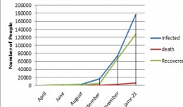
Bouzayani Rajab [1]/ Abida Zouheir[2] [1] Bouzayani Rajab : Faculty of Economics and Management of Sfax, University of Sfax – Tunisia. E-mail: bouzayanilazher@gmail.com [2] Abida Zouheir : Faculty of Economics and Mana...
by Lamouchi Helmi
0


Thumbnail.8.640.360

Reducing Total Freshwater Use in the Gold Processing Industry Using Linear Programming

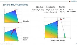
Suliman Emdini Gliwan*1 Kevin Crowe *2 *1Ph.D.Candidate, Faculty of Natural Resource Management, Lakehead University, 955 Oliver Rd, Thunder Bay, ON, Canada (P7B5E1). *2Associate Professor, Faculty of Natural Resource Managemen...
by Lamouchi Helmi
0


06-731x413

Control of a Hybrid Wind-PV and Energy Storage System

Control of a Hybrid Wind-PV and Energy Storage System Mohammed Al Busaidi, Amer Al-Hinai*, Rashid Al-Abri, Mohammed Al-Badi Electrical & Computer Engineering, Sultan Qaboos University, Oman Abstract—Distributed energy gen...
by Lamouchi Helmi
0


images

Modeling Ripeness Grading of Palm Oil Fresh Fruit Bunches through Image Processing using Artificial Neural Network

Modeling Ripeness Grading of Palm Oil Fresh Fruit Bunches through Image Processing using Artificial Neural Network Osama M. Ben Saaed1, Meftah Salem M Alfatni1,2*, Abdul Rashid Mohamed Shariff3 and Hadya S Hawedi1 1Faculty of I...
by Lamouchi Helmi
0


maxresdefault

DETECTIONS OF BUILDINGSDIGITAL SURFACE MODELS DEFORMATIONS GENERATED FROM DRONES NADIR IMAGES

  DETECTIONS OF BUILDINGSDIGITAL SURFACE MODELS DEFORMATIONS GENERATED FROM DRONES NADIR IMAGES Jean A. Doumit*, Souhail F. Awad*,Evgeny N. Kiselev** *Lebanese University, Faculty of Letters and Human Sciences, Department of g...
by Lamouchi Helmi
0


Prezentacja programu PowerPoint

Comparative responses to cadmium toxicity of Arabidopsis thaliana mutant seedling (cad2) and wild type (col0)

Comparative responses to cadmium toxicity of Arabidopsis thaliana mutant seedling (cad2) and wild type (col0) CHAFFEI HAOUARI CHIRAZ1, SLATNI TARAK2, DJEMAL FATMA1, GOUIA HOUDA1 (Company / Faculté des Sciences de Tunis) 1Unive...
by Lamouchi Helmi
0


1320_effects-image

Precision Technologies Role in the Study of Climate Change Impact

The Second session of the International Symposium Precision Technologies Role in the Study of Climate Change Impact and its implications on the Economic and Natural Structure: The reality and suggested solutions Istanbul, Turke...
by Lamouchi Helmi
0


f0ecbd2a-2ed9-458d-91ab-07e1caedea10-9867cc4df536.small

5th International Conference on Water, Energy, Food and Agricultural Technology Istanbul, Turkey, 22-25 January 2019

5th International Conference on Water, Energy, Food and Agricultural Technology Istanbul, Turkey, 22-25 January 2019   Scientific themes 1-      water resources and desertification and agricultural techniques 2-   ...
by Lamouchi Helmi
0


wwwwww

Drone base multiscale Digital Surface Models to planar areas.

Drone base multiscale Digital Surface Models to planar areas. Dr. Jean A. Doumit   Abstract The obtaining of a Digital Surface models (DSMs) at different scales and levels before the appearance of Unmanned Aerial Vehicles (UAV...
by Lamouchi Helmi
0


1

Monitoring of Mosul Reservoir Using Remote Sensing TechniquesFor the Period After ISIS Attack in 9 June 2014

Monitoring of Mosul Reservoir Using Remote Sensing TechniquesFor the Period After ISIS Attack in 9 June 2014 Lecture:  Muthanna Mohammed Abdulhameed AL Bayati University of Technology – Baghdad- Building and Construction Dep...
by Lamouchi Helmi
0


0 comments »


Be the first to comment!


Leave a Reply

Your email address will not be published. Required fields are marked *

*

* Copy This Password *

* Type Or Paste Password Here *

You may use these HTML tags and attributes: <a href="" title=""> <abbr title=""> <acronym title=""> <b> <blockquote cite=""> <cite> <code> <del datetime=""> <em> <i> <q cite=""> <strike> <strong>