Articles and Interviews

6 May 2013

PCI Geomatics Software Supports KOMPSAT-3 Sensor

RICHMOND HILL, Ontario, Canada, May 03, 2013 – PCI Geomatics, a world-leading developer of remote sensing and photogrammetric software and systems, announced today that it now supports KOMPSAT-3 imagery within its software suite.

KOMPSAT-3, a new satellite built and operated by the Korean Aerospace Research Institute (KARI) was launched on May 12th, 2012 from the Tanegashima Space Center of the Japan Aerospace Exploration Agency (JAXA), Japan. KOMPSAT-3 is an optical imaging satellite capable of imaging the Earth with a resolution of 0.70 m Panchromatic and 2.8 m Multispectral (Blue, Green, Red, Near-IR). KOMPSAT-3 includes the Advanced Earth Imaging Sensor System (AEISS), which is a high-resolution imager (Pan and MS). This prime instrument of the mission was developed by KARI.

“We are very pleased with the great effort of PCI Geomatics,” said Dr. TaeByeong CHAE, Head of the Satellite information Proliferation Team at KARI. “With this new and improved solution, KOMPSAT-3 images will be more easily accessible and useful to the public and commercial users around the globe,” he added.

“We have worked closely with KARI to validate our software’s support for KOMPSAT-3 imagery,” said Dr. Philip Cheng, Senior Scientist at PCI Geomatics. “Our software includes support for the new Single Pass Stereo Mode, which will be capable of extracting high-resolution DEMs. Users of our software will also have the ability to pansharpen KOMPSAT-3 imagery.”

PCI has performed quality control on the imagery to determine the achievable accuracy, and found the correction of the KOMPSAT-3 imagery to be very accurate using the Rational Polynomial Coefficients (RPC) provided.  The support for KOMPSAT-3 will be available in a future service pack for Geomatica 2013 and can be deployed now in PCI’s enterprise-level production systems.

PCI’s support for KOMPSAT-3 will include RPC model creation and the Toutin Model (allowing for very accurate corrections using the satellite orbital ephemeris data) as well as rapid and high-quality pansharpening capability. KOMPSAT-3 images have been provided by Satrec Initiative, which holds the exclusive right for global distribution right for the KOMPSAT series of satellites.

For more information on PCI’s support for KOMPSAT-3 and processing capabilities that are available within Geomatica 2013, visit:www.pcigeomatics.com/products/geomatica-2013

About the Korea AeroSpace Research Institute (KARI)

Established in 1989, KARI is devoted to its role as the leading aerospace research and development institute in Korea. KOMPSAT-2 was successfully launched on July 28th 2006 and recently KOMPSAT-3, the latest satellite of KOMPSAT series, was launched on May 18th 2012. KARI is now developing KOMPSAT-3A and KOMPSAT-5 in an effort to expand Korea’s national space development program. The goal of KARI is to establish a 24-hour satellite observation system surrounding the Korean Peninsula through the KOMPSAT series. Find out more about KARI at www.kari.re.kr/eng/

About the Satrec Initiative  

Satrec Initiative (SI) is the leading solution provider for Earth observation missions, offering customers worldwide high performance, cost-effective turnkey satellite platforms, electro-optical instruments, ground systems and components. Focusing on the customers’ needs with innovative technologies, SI has delivered optimized high quality solutions to over 20 customers in the Middle East, Asia and Europe. Si has  exclusive sales right of Kompsat 2, 3 and 5. Find out more about Satrec Initiative at www.satreci.com/eng/

About PCI Geomatics

PCI Geomatics is a world-leading developer of software and systems for remote sensing, imagery processing, and photogrammetry.  With more than 30 years of experience in the geospatial industry, PCI is recognized globally for its excellence in providing software for accurately and rapidly processing both satellite and aerial imagery.  PCI has installed more than 30 thousand licenses, in over 150 countries worldwide. Find out more about PCI Geomatics atwww.pcigeomatics.com.


2

Determine the morphostructure phenomenon, East Khor Al-Zubair by Space Imageries

Dr.TorhanAlmofti *                                         Ahmed Ibrahim Saleh Al-Naemi** Abstract Through the use of satellite data taken by the Landsat satellites a color phenomenon was...
by Lamouchi Helmi
0


1

Detection and monitoring crop of wheat and barley by using NDVI stacking technique and spectral angle mapper algorithm

S K AAl-Hummadi[1] N S Nuaimy[2] A L Ubaidy[3] 1Ministry of science and Technology, ,Remote sensing center, Iraq E-mail: shathamaster@yahoo.com   2Ministry of science and Technology, Remote sensing center, Iraq E-mail: ade...
by Lamouchi Helmi
0


2

Tunisian economy in the face of the Covid-19 pandemic: State of play, analysis and outlook

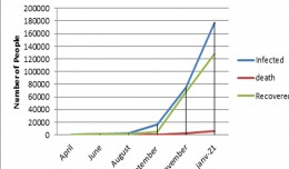
Bouzayani Rajab [1]/ Abida Zouheir[2] [1] Bouzayani Rajab : Faculty of Economics and Management of Sfax, University of Sfax – Tunisia. E-mail: bouzayanilazher@gmail.com [2] Abida Zouheir : Faculty of Economics and Mana...
by Lamouchi Helmi
0


Thumbnail.8.640.360

Reducing Total Freshwater Use in the Gold Processing Industry Using Linear Programming

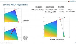
Suliman Emdini Gliwan*1 Kevin Crowe *2 *1Ph.D.Candidate, Faculty of Natural Resource Management, Lakehead University, 955 Oliver Rd, Thunder Bay, ON, Canada (P7B5E1). *2Associate Professor, Faculty of Natural Resource Managemen...
by Lamouchi Helmi
0


06-731x413

Control of a Hybrid Wind-PV and Energy Storage System

Control of a Hybrid Wind-PV and Energy Storage System Mohammed Al Busaidi, Amer Al-Hinai*, Rashid Al-Abri, Mohammed Al-Badi Electrical & Computer Engineering, Sultan Qaboos University, Oman Abstract—Distributed energy gen...
by Lamouchi Helmi
0


images

Modeling Ripeness Grading of Palm Oil Fresh Fruit Bunches through Image Processing using Artificial Neural Network

Modeling Ripeness Grading of Palm Oil Fresh Fruit Bunches through Image Processing using Artificial Neural Network Osama M. Ben Saaed1, Meftah Salem M Alfatni1,2*, Abdul Rashid Mohamed Shariff3 and Hadya S Hawedi1 1Faculty of I...
by Lamouchi Helmi
0


maxresdefault

DETECTIONS OF BUILDINGSDIGITAL SURFACE MODELS DEFORMATIONS GENERATED FROM DRONES NADIR IMAGES

  DETECTIONS OF BUILDINGSDIGITAL SURFACE MODELS DEFORMATIONS GENERATED FROM DRONES NADIR IMAGES Jean A. Doumit*, Souhail F. Awad*,Evgeny N. Kiselev** *Lebanese University, Faculty of Letters and Human Sciences, Department of g...
by Lamouchi Helmi
0


Prezentacja programu PowerPoint

Comparative responses to cadmium toxicity of Arabidopsis thaliana mutant seedling (cad2) and wild type (col0)

Comparative responses to cadmium toxicity of Arabidopsis thaliana mutant seedling (cad2) and wild type (col0) CHAFFEI HAOUARI CHIRAZ1, SLATNI TARAK2, DJEMAL FATMA1, GOUIA HOUDA1 (Company / Faculté des Sciences de Tunis) 1Unive...
by Lamouchi Helmi
0


1320_effects-image

Precision Technologies Role in the Study of Climate Change Impact

The Second session of the International Symposium Precision Technologies Role in the Study of Climate Change Impact and its implications on the Economic and Natural Structure: The reality and suggested solutions Istanbul, Turke...
by Lamouchi Helmi
0


f0ecbd2a-2ed9-458d-91ab-07e1caedea10-9867cc4df536.small

5th International Conference on Water, Energy, Food and Agricultural Technology Istanbul, Turkey, 22-25 January 2019

5th International Conference on Water, Energy, Food and Agricultural Technology Istanbul, Turkey, 22-25 January 2019   Scientific themes 1-      water resources and desertification and agricultural techniques 2-   ...
by Lamouchi Helmi
0


wwwwww

Drone base multiscale Digital Surface Models to planar areas.

Drone base multiscale Digital Surface Models to planar areas. Dr. Jean A. Doumit   Abstract The obtaining of a Digital Surface models (DSMs) at different scales and levels before the appearance of Unmanned Aerial Vehicles (UAV...
by Lamouchi Helmi
0


1

Monitoring of Mosul Reservoir Using Remote Sensing TechniquesFor the Period After ISIS Attack in 9 June 2014

Monitoring of Mosul Reservoir Using Remote Sensing TechniquesFor the Period After ISIS Attack in 9 June 2014 Lecture:  Muthanna Mohammed Abdulhameed AL Bayati University of Technology – Baghdad- Building and Construction Dep...
by Lamouchi Helmi
0


0 comments »


Be the first to comment!


Leave a Reply

Your email address will not be published. Required fields are marked *

*

* Copy This Password *

* Type Or Paste Password Here *

You may use these HTML tags and attributes: <a href="" title=""> <abbr title=""> <acronym title=""> <b> <blockquote cite=""> <cite> <code> <del datetime=""> <em> <i> <q cite=""> <strike> <strong>