Geo SP has been informed that the University of Basra in south of Iraq is preparing the 5th edition of its scientific congress in mid spring 2013. The congress which will be sponsored by the president of the University o...
The head of the Desert Research Center at the University of Abnar, Dr. Salah Faiad, granted the center shield to Prof. Mohamed AYARI, President of the Tunisian Association of the Digital Geographic Information, at the Universit...
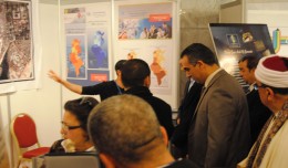
The Tunisian Association of Digital Geographic Information participates in the second scientific congress of desert studies in the Anbar University 24- 26 April 2013, the congress will be held under the slogan “scientific res...
5th International Conference on Water, Energy, Food and Agricultural Technology Istanbul, Turkey, 22-25 January 2019 Scientific themes 1- water resources and desertification and agricultural techniques 2- ...
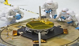
The sole secondary mirror and another primary mirror that will fly aboard NASA’s James Webb Space Telescope arrived at NASA’s Goddard Space Flight Center in Greenbelt, Md., on Nov....
The second flight of ESA’s newest launch vehicle has been completed from Europe’s Spaceport in Kourou, French Guiana. Two Earth observation satellites, ESA’s Proba-V and Vietnam’s VNREDSat‑1A, were released into diffe...
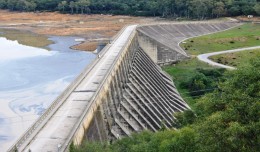
Monitoring of Mosul Reservoir Using Remote Sensing TechniquesFor the Period After ISIS Attack in 9 June 2014 Lecture: Muthanna Mohammed Abdulhameed AL Bayati University of Technology – Baghdad- Building and Construction Dep...
Sheboygan, Wisconsin, May 23, 2013 – AeroMetric announced the addition of a new High Accuracy Mapping Solution for its clients. The new solution is designed to obtain tight vertical accuracy and highly detailed imagery...
5th International Conference on Water Resources and Arid Environments 7-9 January 2013 Organizers: Prince Sultan Bin Abdulaziz International Prize for Water (PSIPW) King Saud University, represented by the Prince Sultan Institu...
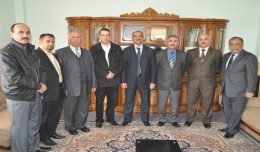
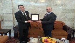
At the beginning of his visit to Iraq, Prof. Mohamed AYARI, president of the Tunisian Association of Digital Geographic Information and president of the Euro-Arab Union of Geomatics met, Mr. Tourhan Almoufti, the Iraqi Minis...
You can work with maps in the field using Esri’s Collector for ArcGIS app on your iPhone or Android smartphone. You can also use maps to capture spatial and tabular data with the phone’s GPS or by tapping on the map...
 English
  Français
  العربية