sig_

Geographic information system

Geographic information system (GIS) is a system designed to capture, store, manipulate, analyze, manage, and present all types of geographical data. The acronym GIS is sometimes used for geographical information science or geos...
by Geo-SP
0


Alphasat_1-XL_large

Alphabus/Alphasat

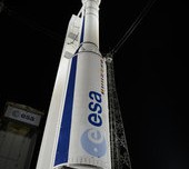
ARTES 8 Alphabus/Alphasat is dedicated to the development and deployment of the Alphasat satellite. Alphasat is being built in partnership between ESA and European operator Inmarsat by Astrium. It is the first satellite to us...
by Lamouchi Helmi
0


Pict1_working meeting

Creation of a digital 3-dimensional model

TogliattiKauchuk Plant – Togliatti, Russia  Laser scanning as a method of storage of spatial information is used in various economic sectors. In this article, we will focus on laser scanning for industrial design, or more pr...
by Lamouchi Helmi
0


707628main_pia16294-946

Global Sea Level

    This figure shows changes in global mean sea level as measured by satellite altimetry (NASA/CNES Topex/Poseidon and Jason-1; and NASA/CNES/NOAA/EUMETSAT Jason-2) between 1992 to 2012. The data have been averaged t...
by Lamouchi Helmi
0


Untitled-2

NASA Finds 2012 Sustained Long-Term Climate Warming Trend

NASA scientists say 2012 was the ninth warmest of any year since 1880, continuing a long-term trend of rising global temperatures. With the exception of 1998, the nine warmest years in the 132-year record all have occurred sinc...
by Lamouchi Helmi
0


1595_481137111962333_1750011374_n

Bluesky’s LiDAR experts educate Mouchel’s water industry professionals

The Mouchel Urban Drainage Academy (MUDA) trains water industry professionals Aerial mapping company Bluesky is helping water industry professionals understand the potential of laser captured height models. Following a request ...
by Lamouchi Helmi
0


700760main_ST_equidistant_orbit-466

NASA Spacecraft Observe Nov. 20 Solar Eruption

On Nov. 20, 2012, at 7:09 a.m. EST, the sun erupted with a coronal mass ejection or CME. Not to be confused with a solar flare, a CME is a solar phenomenon that can send solar particles into space and can reach Earth one to thr...
by Lamouchi Helmi
0


DSC_01551

Minister of communication and Information Technologies opens the activities of the 7th edition of Geotunis

Dr. Monji Marzouk, Minister of communication and Information Technologies opened on Monday, April 8 2013 the activities of the 7th edition of the international congress geotunis held under the slogan: Through geographic infrast...
by Lamouchi Helmi
0


basrahuniv (Large)

University of literature of Basra holds its 5th edition of the Scientific Congress

  Geo SP has been informed that the University of Basra in south of Iraq is preparing the 5th edition of its scientific congress in mid spring 2013. The congress which will be sponsored by the president of the University o...
by Lamouchi Helmi
0