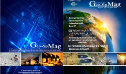
The first edition of GeoSP was published in April. The edition includes several researches and good quality studies which was presented to international arbitration. The first edition includes an interview with the president of...
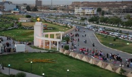
Dr. Mohamed AYARI, president of the Tunisian Association of Digital Geographic Information and president of the Euro-Arab Union of Geomatics visited Kurdistan on December 27 2012 where he met the president of the Association of...
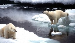
A new NASA-funded study by the National Center for Atmospheric Research, Boulder, Colo., finds climate model projections that show a greater rise in global temperature are likely to prove more accura...
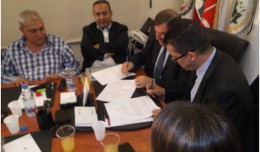
A collaboration protocol was signed on Wednesday morning May 15,2013 inthe Euro-Arab Union of geomatics office inBeirut,Lebanon. The protocol states the technical and scientific cooperation between academics and professionals i...
The second flight of ESA’s newest launch vehicle has been completed from Europe’s Spaceport in Kourou, French Guiana. Two Earth observation satellites, ESA’s Proba-V and Vietnam’s VNREDSat‑1A, were released into diffe...
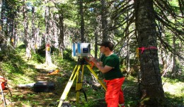
TogliattiKauchuk Plant – Togliatti, Russia Laser scanning as a method of storage of spatial information is used in various economic sectors. In this article, we will focus on laser scanning for industrial design, or more pr...
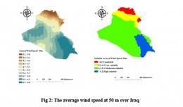
Selecting Suitable Sites for Wind Energy harvesting in Iraq using GIS Techniques WEDYAN G. NASSIF1,2, DALILA ELHMAIDI1 , YASEEN K. Al-TIMIMI2 1 Thermal Radiation Research Unit ,Faculty of Sciences of Tunis ,University o...
18 December 2012, Rome - The global forest products industry is slowly recovering from the economic crisis, with the Asia-Pacific region and particularly China taking the lead. New data published by FAO indicate that on avera...
Rules for the publication: Judging: 1- All researches, studies and articles to be published are subject to a scientific judgment by a scientific committee composed of academics and specialized capacities from Tunisia,...
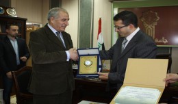
Regarding his efforts in promoting the scientific cooperation between institutions at the Arab and International levels and the use of Geomatics technology, the president of the University of Takrit, Dr. Mzahem Kacem Alkaiat, g...
 English
  Français
  العربية