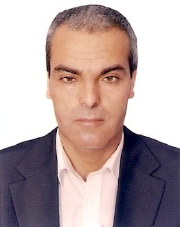
Dr. Abdussalam Ahmed Ibrahim
Personal Details:
Full Name: Abdussalam Ahmad M. Ibrahim
Place of Birth: Tarhuna, Libya
Nationality: Libyan
Languages Spoken: Arabic: Native language, English: Excellent
Address: PO Box 2328 Midyin Al- Jzyir, Post Office, Tripoli, Libya Tel: 00218913211677, Email:
abdussalam_ibrahim@yahoo.com
Area of General Specialization:
Environmental Sciences, Physical Geography, Remote Sensing, GIS and Future Climate Modelling SDSM.
Area of Narrow Specialization:
Digital Images Processing, Applications of Remote Sensing for Environmental, Applications of GIS,
Spatial Analysis and future climate modelling SDSM.
Education
PhD. In Geography and Environmental Sciences, 2010, University of Reading, Reading, UK.
Thesis title: Modelling the relationship between climate and vegetation in theTarhuna region, Libya,
using spatial modelling techniques.
MSc. in Physical Geography, 1999, Bangazi University, Bangazi, Libya. Dissertation title:
Desertification in the Eastern part of the Jifarah Plain, Libya.
Postgraduate Diploma in Physical Geography, 1997, Bangazi University, Bangazi, Libya.
Postgraduate Diploma in Physical Geography, 1995, Tripoli University, Tripoli, Libya.
BSc Geography, 1991, Nasser University, Tripoli, Libya.
Remote sensing, GIS & Database learning skills
1- Database and Administration Systems (oracle).
2- Earth Observation by Remote Sensing.
3- Statistics Training Courses and data analysis by GenStat software.
3- Learning Arc GIS 9.1, ESRI Course.
4- Learning Arc GIS 9.1, 3D Analyst, ESRI Course.
5- Learning Arc GIS 9.1, Spatial Analyst, ESRI Course.
6- Learning Arc GIS 9.1, GIS Application, ESRI Course.
8- Geostatistics for environmental (Kriging) course.
Training & Consulting
Strategic & Operational Planning, German Jordanian University, Amman, 2013.
Academic and Administrative Experience
• Jun. 1994-Nov. 1999, Administrator, Nasser University, Tarhuna, Libya.
• Dec. 1999-Spet. 2003, Assistant lecturer, Nasser University, Tarhuna, Libya.
• Sept. 2003-Apr. 2004, Lecturer, Nasser University, Tarhuna, Libya.
• Oct. 2011 – present, Assistant Professor, Azzaytuna University, Tarhuna, Libya.
• Des. 2011- Present, Postgraduate Teaching of Physical Geography, Remote Sensing, GIS and
Future Climate Modelling SDSM, Libyan Academia, Tripoli, Libya.
• Sept. 2012- Present, Postgraduate Teaching of Remote Sensing, GIS and Future Climate
Modelling SDSM, Tripoli University, Tripoli, Libya.
• Mar. 2012 – present, Head of Sector of Planning in Tarhuna area, Ministry of Planning - Libya
• Oct 2007-Jun 2009, laboratory, Undergraduate Teaching of Remote sensing and GIS.
Geography and Environmental Science Department, Reading University, England
• Jan 2009-Feb 2009, Desert Immigration Project, Fieldwork experience using GPS technology
and total station.
• Sept. 2002-Apr. 2004 Undergraduate Teaching, Environmental Sciences Department, Nasser
University, Tarhuna, Libya.
• Sept. 1999-Apr. 2004 Undergraduate Teaching, Geography Department, Nasser University,
Tarhuna, Libya.
• Jan 2000-Dec. 2003, United Nations development regional representative, development
mapping project (LIB /01/001. 2000-2005), Tarhuna, Libya.
LIB /01/001 UN project was between the national commission for Information and Documentation
and the United Nations Development program. I was responsible to collect quantitative data and to
apply field explorations related to the determination of a development map within the municipalities
and to diagnose the demographic economic and social differences.
• Dec.1999-Aug. 2002 Head of Geography Department, Nasser University, Tarhuna, Libya.
• Sept. 2003-Apr. 2004, Head of Environmental Sciences Department, Nasser University, Tarhuna,
Libya.
• Sept. 2002-Apr. 2004, Libraries Management Administrator, Nasser University, Tarhuna, Libya.
• Sept. 2001-Apr. 2004, Higher Education Administration Officer, Nasser University, Tarhuna, Libya.
• Sept. 1999-April. 2004, Head of Geography Department, Nasser University, Tarhuna, Libya.
• Taught Courses:
1) Undergraduate Courses
- Photogrammetric, Geographic Information Systems (GIS), Applied GIS in Environmental ,
Remote Sensing, Applied Remote Sensing in Environmental, Climate, Desertification
2) Graduate Courses
-Advanced Remote Sensing & GIS, GIS Application, Climate change,
Future climate modeling, Advanced physical geography.
• Supervised Theses:
1) Master Thesis entitled: “Modeling Vegetation Degradation in Al Qarabulli area, Libya Using Spatial
Modeling Technique. Tripoli University, Libya, 2013.
2) Master Thesis entitled: “Modeling Vegetation Degradation in Al Ajaylat area Using Spatial Modeling
Technique. Tripoli University, Libya, 2013.
• External Examiner of Thesis:
1) Master Thesis entitled: “Study the spread of pollutants resulting from the power station of west Az
Zawiyah using the ISC3 system", Libyan Academy, Tripoli 2012.
2) Master Thesis entitled: “Climate variability and its impact on rain-fed agriculture in the area of
Zliten, Libya", Libyan Academy, Tripoli 2012.
Personal Qualities and Technical Skills
I am a very hard working individual, and I am trustworthy, punctual and efficient in all the work that
I carry out. I work well as an individual and as part of a team.
I have experience of analysing data with of GIS software, ERDAS software and Gen stat, other
statistics some knowledge in Illustrator, Oracle and I am competent in all Microsoft Office
applications, Windows XP.
Awards
University of Reading (2007) PGC Research Award of SHES.
University of Reading (2008) PGC Research Award of SHES.
Interests/Hobbies
I like reading books. I am also interested in internet surfing.
Publications
Books
1- Ibrahim, A.A.M. & Sager, I.A. 2005. Desertification in the Eastern part of the Jifarah Plain, Nasser
University Publications, Tripoli, Libya, Pp 250.
2- Ibrahim, A.A.M. & Alhaiti, I. 2005. Remote Sensing- Principles & Applications, Nasser University
Publications, Tripoli, Libya.
Publications
1. Ibrahim, A.A.M. 2013. Estimation of future temperature change in Misurata area – Libya by using
statistical downscaling method (SDSM).The 5th International Conference on Water Resources and
Arid Environments. January 2013, Riyadh, Saudi Arabia.
2. Ibrahim, A.A.M. 2010. Production of digital climatic maps using GIS Geostatistical techniques
(Ordinary Kriging) case study from Libya. The 4th International Conference on Water Resources
and Arid Environments, December 2010, Riyadh, Saudi Arabia.
3. Ibrahim, A.A.M., 2003. The urban growth and Environmental problems (Tripoli case study). The
Third Arabic Geographical Conference, October 2003, Riyadh, Saudi Arabia.
4. Ibrahim, A.A.M General Problems on the rains in Tarhuna region. The Seventh Geographical
Forum, Sept. 2001, Misallata, Libya.
5. Ibrahim, A.A.M Cusses of Desertification in the region of Khalij Sirt. The First Scientific Conference,
the Natural Resources in the Khalij Sirt, November 1999, Sirt, Libya.
6. Ibrahim, A.A.M 1999. Climate and Agriculture in North-Western Libya. The Sixth Geographical
Forum, Sept. 1999, Derna, Libya.
7. Ibrahim, A.A.M. 1997. Causes and features of desertification (case study, Libya). The First Scientific
Symposium on Water and Desertification problem, July 1997, Tripoli, Libya.
References
1. Dr. Kevin White, Environments Remote Sensing, Earth system science Research Group. School of
Environmental Science. The University of Reading Whiteknights Reading RG6 6AB UK. Tel 0118
3787752 Fax 0118 9755865, Email k.h.white@reading.ac.uk, url: http://www.rdg.ac.uk/~sgswitke/
2. Dr Geoffrey Griffiths, Landscape and biodiversity, Development of GIS/remote sensing techniques
for predictive vegetation mapping, Human Environments Research Group, School of Environmental
Science. The University of Reading Whiteknights Reading RG6 6AB UK. Tel +44 (0) 118 378 8737
Fax +44 (0) 118 9755865, Email g.h.griffiths@reading.ac.uk
3. Prof. Adel Radi. Damascus. Zaki Al Halabi Street No: 9, Tel: +963113342414 Email:
paradiradi@yahoo.fr .
4. Prof. Khaleb Ben Mahmmod, Al-Fateh University, Tripoli Libya .P.O.Box 13538 .Fax
00218213616845

 English
  Français
  العربية


