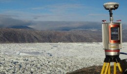
RIEGL goes for ultra-long ranges: VZ-6000 offers more than 6,000 m measurement range Horn, Austria, September 24, 2012 – Especially designed for ultra-long range applications in topograp...
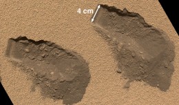
PASADENA, Calif. – NASA’s Mars Curiosity rover has used its full array of instruments to analyze Martian soil for the first time, and found a complex chemistry within the Martian soil. Water and sulfur and chlorine-...
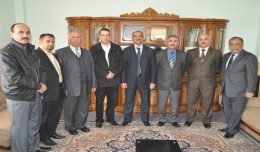
The head of the Desert Research Center at the University of Abnar, Dr. Salah Faiad, granted the center shield to Prof. Mohamed AYARI, President of the Tunisian Association of the Digital Geographic Information, at the Universit...
DETECTIONS OF BUILDINGSDIGITAL SURFACE MODELS DEFORMATIONS GENERATED FROM DRONES NADIR IMAGES Jean A. Doumit*, Souhail F. Awad*,Evgeny N. Kiselev** *Lebanese University, Faculty of Letters and Human Sciences, Department of g...
You can work with maps in the field using Esri’s Collector for ArcGIS app on your iPhone or Android smartphone. You can also use maps to capture spatial and tabular data with the phone’s GPS or by tapping on the map...
Suliman Emdini Gliwan*1 Kevin Crowe *2 *1Ph.D.Candidate, Faculty of Natural Resource Management, Lakehead University, 955 Oliver Rd, Thunder Bay, ON, Canada (P7B5E1). *2Associate Professor, Faculty of Natural Resource Managemen...
WEAP (Water Evolution and Planning) has been looking for solutions to preserve fresh water and developing strategies to live within certain water budget in a sustainable manner. WEAP’s teamwork is working in almost all over t...
The Mouchel Urban Drainage Academy (MUDA) trains water industry professionals Aerial mapping company Bluesky is helping water industry professionals understand the potential of laser captured height models. Following a request ...
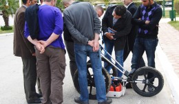
MDS, institution specialized in Georadar technology organized a workshop, within the framework of the 7th edition of Geotunis 8-12 April 2013. The workshop was supervised by Prof. Philippe Xavier, who presented the latest techn...
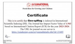
Geo-spMag Journal Achieves Impact Factor of 1.943 in ISI Indexing Geo-spMag Journal Achieves Impact Factor of 1.943 in ISI Indexing In a significant milestone for Arab scientific publishing, the international peer-reviewed jour...
 English
  Français
  العربية