Control of a Hybrid Wind-PV and Energy Storage System Mohammed Al Busaidi, Amer Al-Hinai*, Rashid Al-Abri, Mohammed Al-Badi Electrical & Computer Engineering, Sultan Qaboos University, Oman Abstract—Distributed energy gen...
Study the characteristics and nature of the Indian dates tree. Tamarindus Indica L In the southwestern region (Jizan and Asir) Corresponding Author Mosaed Saeed Ali Alhader King Abdulaziz City for Science and Technology General...
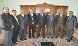
A collaboration protocol was signed on Wednesday morning May 15,2013 inthe Euro-Arab Union of geomatics office inBeirut,Lebanon. The protocol states the technical and scientific cooperation between academics and professionals i...
Publication in international scientific magazines and journals, holding an international standard serial number has been subject for debate during the latest period. Scientists, academics and researchers are in a contentious se...
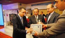
The head of the Desert Research Center at the University of Abnar, Dr. Salah Faiad, granted the center shield to Prof. Mohamed AYARI, President of the Tunisian Association of the Digital Geographic Information, at the Universit...
On Monday, April 8, 2013, the Minister of Information Technologies and Communication, Dr Monji Marzouk, in company with governmental stuff and the president of Geotunis, opened the international exhibition of geomatics technolo...
WEAP (Water Evolution and Planning) has been looking for solutions to preserve fresh water and developing strategies to live within certain water budget in a sustainable manner. WEAP’s teamwork is working in almost all over t...
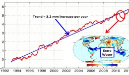
This figure shows changes in global mean sea level as measured by satellite altimetry (NASA/CNES Topex/Poseidon and Jason-1; and NASA/CNES/NOAA/EUMETSAT Jason-2) between 1992 to 2012. The data have been averaged t...
Sheboygan, Wisconsin, May 23, 2013 – AeroMetric announced the addition of a new High Accuracy Mapping Solution for its clients. The new solution is designed to obtain tight vertical accuracy and highly detailed imagery...
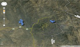
The President of the Tunisian Association of Digital Geographic Information, Mr. Mohamed AYARI with a delegation from the Association visited Algeria from December 09 to December 15, 2012. The travel included a visit to a numbe...
A new NASA-funded study by the National Center for Atmospheric Research, Boulder, Colo., finds climate model projections that show a greater rise in global temperature are likely to prove more accura...
 English
  Français
  العربية