10 July 2013

Soil Salinity Mapping Model Developed Using RS and GIS in Libya

Abstract

DDD

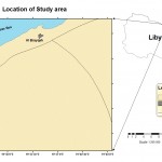
The challenge faces the world in the coming decades is to provide an adequate food supply for increasing populations. The food supply should be granted to 6 billion inhabitants on 2000 and excepted 8 billion people in 2025. Food supply shortages occurs in arid and semi-arid zones where a land degradation and desertification are the main obstacles facing sustainable agriculture. Soil Salinisation is one of the most common land degradation processes in arid and semi-arid regions, where evaporation exceed over precipitation. Under such climatic conditions, soluble salts are accumulated in the soil, influencing soil properties and environment with ultimate decline in soil productivity. Therefore, mapping of saline areas is essential for understanding resource for sustainable soil uses and management. This paper presents a model to map soil salinity using Remote Sensing (RS) and Geographic Information Systems (GIS).  The model development consists of a number of phases, salinity detection using RS data, site observations, correlation and verification, and validation. Multi–temporal Landsat-7 ETM image (Enhanced Thematic Mapper) acquired in 2000 and 2002 were used to detect coastal saline areas. GIS was used to integrate the available data and information, design the model, and to create different maps. The correlation between the salinity maps developed from visual interpretation of remote sensing data, and site observations shows that the saline areas delineated using remote sensing data fits with those delineated using site observations data. The study confirmed that ground truth coupled with RS data and GIS techniques are powerful tools in detecting salinity at different levels in arid conditions. The model can be adopted elsewhere in similar areas that experience salinisation problems.

Writer
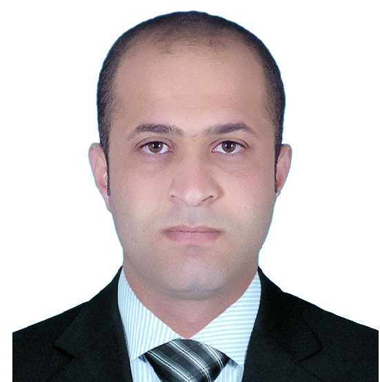
Hamdi Zurqani

PERSONAL INFORMATION:
Date of Birth: 07thDec1981(Tripoli).Gender: Male.Marital Status: Married. Nationality: Libyan.
EDUCATION:
  • Completedall Coursesrequired for BSc of Agriculture, Soil and Water Department, Faculty of Agriculture Tripoli University (Tripoli).
  • Advanced Diploma in Techniques of Agriculture, Department of (Soil and Water), The Higher Institute of agricultural techniques (Al_Gheiran).
WORK EXPERIENCE:
  • Lecturer at Department of  Natural Resources, Faculty of Agriculture Tripoli University (Aljfarh).
May 2011- Present
 Jul 2010 - Nov 2011
TRAINING:
  • Use system ArcGIS / Info System, Natural Resource Mapping Project for agricultural use and planning. (Tripoli)
  • English language level (Lower Starter), Language Center University of Tripoli. (Tripoli)
  • Electronic archiving, Third Millennium CompanyConsulting, fortraining and information technology. (Tripoli, Al-Andalus)
  • English language levels(Beginner, and Elementary1),Al_Jwape Company,for technologyand training. (Tripoli, Al-Andalus)
  SKILLS:

Language

-Excellent in Arabic.- Good in English.

Computer knowledge

Proficiency in dealing with major operating systems Windows, and operating systems Micro Soft Office assistance, and international information network Internet.
ACTIVITIES:
  • The head of Examinations Department, Faculty of Agriculture,
University of Tripoli. (Aljafarah)
  • Member of Information and Public Relations (elected) in Union  Teaching
Staff member, Faculty of Agriculture, University of Tripoli. (Tripoli)
PUBLISHED SCIENTIFIC PAPERS:
  • H,Zurqani; B,Nwer and E, Rhoma (2012) "Assessment of Spatial and Temporal Variations of Soil Salinity using Remote Sensing and Geographic Information System in Libya" Annual International Conference on Geologcail and Earth Sicence ( GEOS)  3-4 December 2012 , Singapore, Singapore, pp 103-106.
SEMINARS ANDSCIENTIFIC CONFERENCES:
  • Annual International Conference on Geologcailand Earth Sicence ( GEOS)  3-4 December 2012, Singapore, Singapore.
HOBBIES:
Swimming, Walking, Chess.

Full Research


a4

Selecting Suitable Sites for Wind Energy harvesting in Iraq using GIS Techniques

Selecting Suitable Sites for Wind Energy harvesting in Iraq using GIS Techniques  WEDYAN G. NASSIF1,2, DALILA ELHMAIDI1 , YASEEN  K. Al-TIMIMI2  1 Thermal Radiation Research Unit ,Faculty of Sciences of Tunis ,University  o...
by Lamouchi Helmi
0


a3

Machine Learning and Statically for Evaluating the Classification of Medical and Lab Services

Machine Learning and Statically for Evaluating the Classification of Medical and Lab Services Muna R. Harbi1,,Loay E. George2 1.Department of Physics, General Directorate of Thi-Qar Education, Ministry of Education, Thi-Qar, Ir...
by Lamouchi Helmi
0


a2

Study the characteristics and nature of the Indian dates tree. Tamarindus Indica L In the southwestern region (Jizan and Asir)

Study the characteristics and nature of the Indian dates tree. Tamarindus Indica L In the southwestern region (Jizan and Asir) Corresponding Author Mosaed Saeed Ali Alhader King Abdulaziz City for Science and Technology General...
by Lamouchi Helmi
0


2

Determine the morphostructure phenomenon, East Khor Al-Zubair by Space Imageries

Dr.TorhanAlmofti *                                         Ahmed Ibrahim Saleh Al-Naemi** Abstract Through the use of satellite data taken by the Landsat satellites a color phenomenon was...
by Lamouchi Helmi
0


1

Detection and monitoring crop of wheat and barley by using NDVI stacking technique and spectral angle mapper algorithm

S K AAl-Hummadi[1] N S Nuaimy[2] A L Ubaidy[3] 1Ministry of science and Technology, ,Remote sensing center, Iraq E-mail: shathamaster@yahoo.com   2Ministry of science and Technology, Remote sensing center, Iraq E-mail: ade...
by Lamouchi Helmi
0


2

Tunisian economy in the face of the Covid-19 pandemic: State of play, analysis and outlook

Bouzayani Rajab [1]/ Abida Zouheir[2] [1] Bouzayani Rajab : Faculty of Economics and Management of Sfax, University of Sfax – Tunisia. E-mail: bouzayanilazher@gmail.com [2] Abida Zouheir : Faculty of Economics and Mana...
by Lamouchi Helmi
0


Thumbnail.8.640.360

Reducing Total Freshwater Use in the Gold Processing Industry Using Linear Programming

Suliman Emdini Gliwan*1 Kevin Crowe *2 *1Ph.D.Candidate, Faculty of Natural Resource Management, Lakehead University, 955 Oliver Rd, Thunder Bay, ON, Canada (P7B5E1). *2Associate Professor, Faculty of Natural Resource Managemen...
by Lamouchi Helmi
0


06-731x413

Control of a Hybrid Wind-PV and Energy Storage System

Control of a Hybrid Wind-PV and Energy Storage System Mohammed Al Busaidi, Amer Al-Hinai*, Rashid Al-Abri, Mohammed Al-Badi Electrical & Computer Engineering, Sultan Qaboos University, Oman Abstract—Distributed energy gen...
by Lamouchi Helmi
0


images

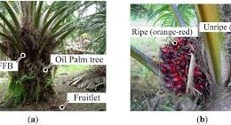
Modeling Ripeness Grading of Palm Oil Fresh Fruit Bunches through Image Processing using Artificial Neural Network

Modeling Ripeness Grading of Palm Oil Fresh Fruit Bunches through Image Processing using Artificial Neural Network Osama M. Ben Saaed1, Meftah Salem M Alfatni1,2*, Abdul Rashid Mohamed Shariff3 and Hadya S Hawedi1 1Faculty of I...
by Lamouchi Helmi
0


maxresdefault

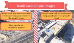
DETECTIONS OF BUILDINGSDIGITAL SURFACE MODELS DEFORMATIONS GENERATED FROM DRONES NADIR IMAGES

  DETECTIONS OF BUILDINGSDIGITAL SURFACE MODELS DEFORMATIONS GENERATED FROM DRONES NADIR IMAGES Jean A. Doumit*, Souhail F. Awad*,Evgeny N. Kiselev** *Lebanese University, Faculty of Letters and Human Sciences, Department of g...
by Lamouchi Helmi
0


Prezentacja programu PowerPoint

Comparative responses to cadmium toxicity of Arabidopsis thaliana mutant seedling (cad2) and wild type (col0)

Comparative responses to cadmium toxicity of Arabidopsis thaliana mutant seedling (cad2) and wild type (col0) CHAFFEI HAOUARI CHIRAZ1, SLATNI TARAK2, DJEMAL FATMA1, GOUIA HOUDA1 (Company / Faculté des Sciences de Tunis) 1Unive...
by Lamouchi Helmi
0


wwwwww

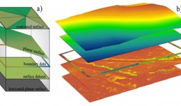
Drone base multiscale Digital Surface Models to planar areas.

Drone base multiscale Digital Surface Models to planar areas. Dr. Jean A. Doumit   Abstract The obtaining of a Digital Surface models (DSMs) at different scales and levels before the appearance of Unmanned Aerial Vehicles (UAV...
by Lamouchi Helmi
0


0 comments »


Be the first to comment!


Leave a Reply

Your email address will not be published. Required fields are marked *

*

* Copy This Password *

* Type Or Paste Password Here *

You may use these HTML tags and attributes: <a href="" title=""> <abbr title=""> <acronym title=""> <b> <blockquote cite=""> <cite> <code> <del datetime=""> <em> <i> <q cite=""> <strike> <strong>