Abstract
Nowadays, GIS and RS satellite imagery are widely recognized as a valuable decision support
system which enable the determination of studying and monitoring urban growth based on a group
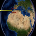
of criteria as well as RS data. This paper aims to monitor the expansion of urban growth in Oujda
city and Saidia coastal zone in the southeast Morocco. Several satellite imagery, databases with
help of ancillary date have been gathered, analyzed, processed and integrated for study area. several
techniques were applied to IKONOS and SPOT august 2007 and Landsate TM and ETM acquired
from 1984 till 2011 covered the entire of Oujda city.The accomplished results show that supervised
classification derived from merged SPOT and ETM have a good and remarkable results than
maximum supervised classification whereas PCA was better than NDVI in identifying the urban
growth easily. However, more accurate results obtained from IKONOS, SPOT than Landsat. The
findings indicate that most of the changes have been taken place in the urban area, bare and
irrigated land. Urban area shifted from 711.22 hectares in 1970 to reach 3664.03 in 2009, and the
other classes were normally altered. On the other hand, the urban area in Saidia city has been
increased from 6.5 hectares in 1988 to 28.7 hectares in 2002.
Writer
Mohamed Ibrahim Amarah
- 3D Analysis of Surfaces and Features using ArcGIS10 ( 3hours).
- 3D Visualization Techniques using ArcGIS10( 3hours).
- Creating 3D data using ArcGIS10 (3hours).
- Deriving Rasters for Terrain Analysis using ArcGIS10 (3 hours).
- Getting started with ArcGIS10 ( 9 hours).
- Introduction to Surface Modeling using ArcGIS10 (3hours).
- Learning ArcGIS Desktop for ArcGIS10 (24 hours).
 English
  Français
  العربية


