English
  Français
  العربية

Abstract

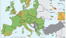
Groundwater is the main source of freshwater in Libya, providing a vital supplement to surface water sources. Groundwater availability and quality are; however, vulnerable to both climate change and over-abstraction, and in regions where the water table has lowered there has been a consequent impact on irrigated agricultures. This paper study the impact of water table change on agricultural areas as a part of the land cover in part of NW Libya during the period 1988 to 2000. Landsat TM data from 1988, 1992, 1996 and 2000 have been integrated with various thematic maps of the study area and with well/bore-hole data to assess the nature and extent of change. A supervised Maximum Likelihood approach was used to classify each image into land cover classes that were deemed sensitive to change in groundwater levels, rather than producing a map of all land cover classes present in the area. QuickBird (2002) and Spot 5 (2000) were used to aid selection of the training sets and to test the accuracy of the classified images, with resulting accuracies of over 80% obtained. changes in agricultural areas are readily apparent, especially the reduction in citrus and other fruit cultivation, which require abundant supplies of irrigation water, (64.6% reduction from 2000 compared to 1988). There is, however, variability in the change observed, with those areas where groundwater levels have changed little not experiencing change in land cover / land use, reinforcing the perceived link between land cover change and groundwater levels. This was further demonstrated by a questionnaire survey distributed to farmers in the region. Results from the questionnaire analysis have confirmed many of the changes noted in the remote sensing results, as well as articulating the link between groundwater and changes in agricultural activity, helping to interpret the classes seen in a socio-economic context.
Writer
TAREK MOKHTAR EL ASWED
Research
My future research plans are to build on the foundation of my PhD to further develop models and tools in conjunction with government bodies, environment agencies. I have a particular interest in the hydrological, environmental and geological studies utilize remotely sensed data by different image processing methods and geographical information system.Education
- Jan 2005- June 2009, PhD: - Geography, School of Social Sciences, Dundee University, UK.
- Oct 1997 – July 1999, MSc in Remote Sensing, Image Processing and Applications, Department of Applied Physics and Electronic and Manufacturing Engineering, Dundee University, UK.
- Sep 1986 – Oct 1989, B.Sc. Soil and Water Engineering department, Agriculture college, Al-Fatah University, Tripoli, Libya.
- Feb 1992- Sep 1995 Agriculture Ministry, El Zawia –Libya. Task: Member of management staff. E.g. provide advises to farmers and run agriculture activities programs.
- Jan 1990- July 1991 Voluntary work “military service”. Training - Space cartography course, by GDTA professional training in satellite imagery applications, 8th – 19th of April 2002. Ramonville St-Agne Cedex, France - ER Mapper advanced training course, by the Earth Resource Mapping, 9th – 17th of December 2002. London, UK Memberships- A member in United Kingdom Remote Sensing and Photgrammatry society