English
  Français
  العربية

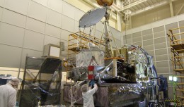
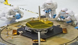
NASA’s GPM Observatory Completes First Dry Run
NASA’s Global Precipitation Measurement (GPM) Core Observatory satellite went through its first complete comprehensive performance test (CPT), beginning on Oct. 4, 2012 at NASA’s Goddard ...