Home
About us
Contact
English
Français
العربية
Home
About us
Evaluation Committee
Publishing Guide
Research
Events
Books and letters
Books
Contact
Recent
Most Commented
Random
Published Researches
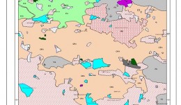
Mapping of water nitrogen pollution from agricultural sources in Poland
by Ali Neji
0
Full Review »
Published Researches
Evaluation of ground water potential zones of nakkavagu catchment in hyderabad, andhra pradesh, India by using Remote sensing and Gis Technique.
by Ali Neji
0
Full Review »
Published Researches
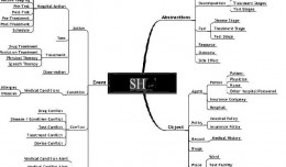
Improve Of Health care Systems for Smart Hospitals Based on UML and Semantic Web Technology
by Ali Neji
0
Full Review »
Published Researches
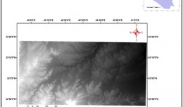
LINEAMENT EXTRACTION FOR ASSESSMENT OF GROUNDWATER AVAILABILITY POTENTIAL / WEST OF IRAQ
by Ali Neji
0
Full Review »
Published Researches
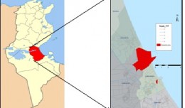
Spatial assessment of water quality data in a’seeb area, Oman using gis
by Ali Neji
0
Full Review »
Published Researches
Using QuickBird Satellite Images to Study Salinity Effect on Date Palm Field
by Ali Neji
0
Full Review »
Published Researches
Using GIS for Highway Design: A Case Study
by Ali Neji
0
Full Review »
Published Researches
STATISTICAL, INVENTORY AND GEOSTATISTICAL STUDIES OF PM10 ATMOSPHERIC AEROSOLS IN THE GULF OF GABÈS, SOUTH TUNISIA
by Ali Neji
0
Full Review »
Published Researches
The Development of Iraqi Datum for Building GIS database
by Ali Neji
0
Full Review »
Page 1 of 7
1
2
3
4
5
6
7
The Latest
News
Articles and Interviews
Reporting Geo-sp
Published Researches
International Conference on Social and Human Sciences
Precision Technologies Role in the Study of Climate Change Impact
5th International Conference on Water, Energy, Food and Agricultural Technology Istanbul, Turkey, 22-25 January 2019
Bluesky’s LiDAR experts educate Mouchel’s water industry professionals
Creation of a digital 3-dimensional model
AeroMetric Announces New High Accuracy Mapping Solution
Interview with George Gartner
Measuring earth’s vital magnetic field
Selecting Suitable Sites for Wind Energy harvesting in Iraq using GIS Techniques
Machine Learning and Statically for Evaluating the Classification of Medical and Lab Services
Study the characteristics and nature of the Indian dates tree. Tamarindus Indica L In the southwestern region (Jizan and Asir)
More »
More »
More »
More »
 English
  Français
  العربية