Abstract
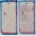
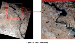
One possible method to detect the vegetation condition under harsh environment is to use vegetation indices throughout remote sensing imagery. Remote sensing tools can be used to monitor any changes in vegetation condition in saline environments. This study was carried out on an experimental date palm field with three salinity levels, 5, 10, and 15 dS/m. Change detection techniques using high resolution satellite images (QuickBird) were used to observe vegetation changes in three years 2003, 2005, and 2008. Satellite images for the experimental date palm filed were analyzed using Emergency Response Dose Assessment System (ERDAS) imagine software to study the vegetation changes based on Soil Adjusted Vegetation Index (SAVI). The results showed significant various responses between date palm trees grown at salinity levels, 5, 10, 15 dS/m in the three time periods. The date palm growth conditions were highest during year 2003 then started to deteriorate with time. In general, the vegetation index was highest for date palm trees grown at 5 dS/m, indicating good trees condition and health. Whereas trees grown at 10 and 15 dS/m showed lower vegetation indices, respectively, indicating poorer trees growth condition.
 English
  Français
  العربية


