Published Researches

14 August 2024

Selecting Suitable Sites for Wind Energy harvesting in Iraq using GIS Techniques

Selecting Suitable Sites for Wind Energy harvesting in Iraq using GIS Techniques 

WEDYAN G. NASSIF1,2, DALILA ELHMAIDI1 , YASEEN  K. Al-TIMIMI2 

1 Thermal Radiation Research Unit ,Faculty of Sciences of Tunis ,University  of Tunis El Manar, 2092 , Tunis. Tunisia

2Department of Atmospheric Science, College of Science, Mustansiriyah University, Baghdad, Iraq

*Corresponding author’s email :wedyan.atmsc@uomustansiriyah.edu.iq

                                   dalila.elhmaidi@fst.utm.tn

yaseen.altimimi.atmsc @uomustansiriyah.edu.iq

Abstract

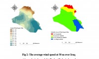
Wind energy is energy extracted from the kinetic energy of the wind by using wind turbines to produce electric energy. Wind energy is one of the most important types of renewable energy that has been widely used as an alternative to fossil fuels. It is abundant and renewable energy, but its availability varies from one location to another. The study aims to identify the best sites for wind energy in Iraq in order to produce the needed future energy from renewable sources. Multi-criteria analysis was used to determine the most suitable sites for harvesting wind energy using Geographic Information System (GIS). The most important data collected was climatic data and which includes a RASTER file of annual wind speed, temperatures, precipitation. soil moisture and NDVI (Normalized Difference Vegetation Index), covering the study area over the past forty years., In addition, the shape file was used for each (distance from power lines, roads, Cities, slopes, and land use), where an appropriate model based on geographic information systems was produced when a set of raster data sets were classified and overlayed by the weighted overlay tool in Spatial Analysis Tools in ArcGIS 10.7.1. The results indicated that the best suitable sites for harvesting wind energy are located in the southeastern regions of Iraq. It is characterized by wind activity with a speed of more than 6.2 m / s. On the other hand, these areas are close to power transmission lines, roads, and slopes are moderate. Therefore, these areas were considered suitable for wind farms. Moreover, areas with a high suitability index cover 1% of the total area, which is an important indicator of wind energy harvesting potential in Iraq. The area with a moderate suitability index covers 71%, and the low suitability index was 15%, while 13% of unsuitable have been identified.

Key words: Wind Energy (WE),  Multi-criteria, GIS, Iraq.


a3

Machine Learning and Statically for Evaluating the Classification of Medical and Lab Services

Machine Learning and Statically for Evaluating the Classification of Medical and Lab Services Muna R. Harbi1,,Loay E. George2 1.Department of Physics, General Directorate of Thi-Qar Education, Ministry of Education, Thi-Qar, Ir...
by Lamouchi Helmi
0


a2

Study the characteristics and nature of the Indian dates tree. Tamarindus Indica L In the southwestern region (Jizan and Asir)

Study the characteristics and nature of the Indian dates tree. Tamarindus Indica L In the southwestern region (Jizan and Asir) Corresponding Author Mosaed Saeed Ali Alhader King Abdulaziz City for Science and Technology General...
by Lamouchi Helmi
0


2

Determine the morphostructure phenomenon, East Khor Al-Zubair by Space Imageries

Dr.TorhanAlmofti *                                         Ahmed Ibrahim Saleh Al-Naemi** Abstract Through the use of satellite data taken by the Landsat satellites a color phenomenon was...
by Lamouchi Helmi
0


1

Detection and monitoring crop of wheat and barley by using NDVI stacking technique and spectral angle mapper algorithm

S K AAl-Hummadi[1] N S Nuaimy[2] A L Ubaidy[3] 1Ministry of science and Technology, ,Remote sensing center, Iraq E-mail: shathamaster@yahoo.com   2Ministry of science and Technology, Remote sensing center, Iraq E-mail: ade...
by Lamouchi Helmi
0


2

Tunisian economy in the face of the Covid-19 pandemic: State of play, analysis and outlook

Bouzayani Rajab [1]/ Abida Zouheir[2] [1] Bouzayani Rajab : Faculty of Economics and Management of Sfax, University of Sfax – Tunisia. E-mail: bouzayanilazher@gmail.com [2] Abida Zouheir : Faculty of Economics and Mana...
by Lamouchi Helmi
0


Thumbnail.8.640.360

Reducing Total Freshwater Use in the Gold Processing Industry Using Linear Programming

Suliman Emdini Gliwan*1 Kevin Crowe *2 *1Ph.D.Candidate, Faculty of Natural Resource Management, Lakehead University, 955 Oliver Rd, Thunder Bay, ON, Canada (P7B5E1). *2Associate Professor, Faculty of Natural Resource Managemen...
by Lamouchi Helmi
0


06-731x413

Control of a Hybrid Wind-PV and Energy Storage System

Control of a Hybrid Wind-PV and Energy Storage System Mohammed Al Busaidi, Amer Al-Hinai*, Rashid Al-Abri, Mohammed Al-Badi Electrical & Computer Engineering, Sultan Qaboos University, Oman Abstract—Distributed energy gen...
by Lamouchi Helmi
0


images

Modeling Ripeness Grading of Palm Oil Fresh Fruit Bunches through Image Processing using Artificial Neural Network

Modeling Ripeness Grading of Palm Oil Fresh Fruit Bunches through Image Processing using Artificial Neural Network Osama M. Ben Saaed1, Meftah Salem M Alfatni1,2*, Abdul Rashid Mohamed Shariff3 and Hadya S Hawedi1 1Faculty of I...
by Lamouchi Helmi
0


maxresdefault

DETECTIONS OF BUILDINGSDIGITAL SURFACE MODELS DEFORMATIONS GENERATED FROM DRONES NADIR IMAGES

  DETECTIONS OF BUILDINGSDIGITAL SURFACE MODELS DEFORMATIONS GENERATED FROM DRONES NADIR IMAGES Jean A. Doumit*, Souhail F. Awad*,Evgeny N. Kiselev** *Lebanese University, Faculty of Letters and Human Sciences, Department of g...
by Lamouchi Helmi
0


Prezentacja programu PowerPoint

Comparative responses to cadmium toxicity of Arabidopsis thaliana mutant seedling (cad2) and wild type (col0)

Comparative responses to cadmium toxicity of Arabidopsis thaliana mutant seedling (cad2) and wild type (col0) CHAFFEI HAOUARI CHIRAZ1, SLATNI TARAK2, DJEMAL FATMA1, GOUIA HOUDA1 (Company / Faculté des Sciences de Tunis) 1Unive...
by Lamouchi Helmi
0


wwwwww

Drone base multiscale Digital Surface Models to planar areas.

Drone base multiscale Digital Surface Models to planar areas. Dr. Jean A. Doumit   Abstract The obtaining of a Digital Surface models (DSMs) at different scales and levels before the appearance of Unmanned Aerial Vehicles (UAV...
by Lamouchi Helmi
0


1

Monitoring of Mosul Reservoir Using Remote Sensing TechniquesFor the Period After ISIS Attack in 9 June 2014

Monitoring of Mosul Reservoir Using Remote Sensing TechniquesFor the Period After ISIS Attack in 9 June 2014 Lecture:  Muthanna Mohammed Abdulhameed AL Bayati University of Technology – Baghdad- Building and Construction Dep...
by Lamouchi Helmi
0


0 comments »


Be the first to comment!


Leave a Reply

Your email address will not be published. Required fields are marked *

*

* Copy This Password *

* Type Or Paste Password Here *

You may use these HTML tags and attributes: <a href="" title=""> <abbr title=""> <acronym title=""> <b> <blockquote cite=""> <cite> <code> <del datetime=""> <em> <i> <q cite=""> <strike> <strong>