Geographic information system (GIS) is a system designed to capture, store, manipulate, analyze, manage, and present all types of geographical data. The acronym GIS is sometimes used for geographical information science or geos...
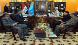
Dr. Mohamed AYARI, president of the Tunisian Association of Digital Geographic Information and president of the Euro-Arab of Geomatics, visited on December 24 and 25 2012 the University of Anbar where he discussed with the pres...
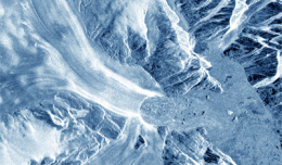
30 November 2012 After two decades of satellite observations, an international team of experts brought together by ESA and NASA has produced the most accurate assessment of ice losses from Antarctica and Greenland to date. This...
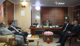
As a respect of his effort aiming at enhancing the scientific exchange at the Arab and international levels, the president of the University of Anbar, Dr kalil Ibrahim, has granted Prof. Mohamed AYARI, president of the Tunisian...
RICHMOND HILL, Ontario, Canada, May 03, 2013 – PCI Geomatics, a world-leading developer of remote sensing and photogrammetric software and systems, announced today that it now supports KOMPSAT-3 imagery within its softwa...
The editing committee of GeoSP has interviewed Mr. George Gartner president of ICA and the international academic researcher about the role of ICA in supporting scientific research and young researchers. Mr. Gartner expressed a...
Geo SP has been informed that the University of Basra in south of Iraq is preparing the 5th edition of its scientific congress in mid spring 2013. The congress which will be sponsored by the president of the University o...
The President of the Tunisian Association of Digital Geographic Information, Mr. Mohamed AYARI with a delegation from the Association visited Algeria from December 09 to December 15, 2012. The travel included a visit to a numbe...
The sole secondary mirror and another primary mirror that will fly aboard NASA’s James Webb Space Telescope arrived at NASA’s Goddard Space Flight Center in Greenbelt, Md., on Nov....
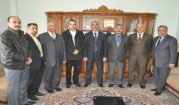
The head of the Desert Research Center at the University of Abnar, Dr. Salah Faiad, granted the center shield to Prof. Mohamed AYARI, President of the Tunisian Association of the Digital Geographic Information, at the Universit...
 English
  Français
  العربية