English
  Français
  العربية


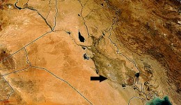
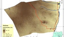
Determine the morphostructure phenomenon, East Khor Al-Zubair by Space Imageries
Dr.TorhanAlmofti * Ahmed Ibrahim Saleh Al-Naemi** Abstract Through the use of satellite data taken by the Landsat satellites a color phenomenon was...