Home
About us
Contact
English
Français
العربية
Home
About us
Evaluation Committee
Publishing Guide
Research
Events
Books and letters
Books
Contact
Sort
Recent
Most Commented
Random
Published Researches
Comparison between «Local» and «Regional» spectrometric soil total carbon models calibrated in Djerid arid area.
by Ali Neji
0
Full Review »
Published Researches
Monitoring Desert Creeping Disaster in Sudan
by Lamouchi Helmi
0
Full Review »
Published Researches
The Sustainable Groundwater Management in Iran; a Novel and Practical Solution
by Lamouchi Helmi
0
Full Review »
Published Researches
Evaluation of irrigated Groundwater Suitability in (Makhmour Hydrogeologic Basin) Using Advanced GIS Techniques
by Lamouchi Helmi
0
Full Review »
Published Researches
Suitability analysis techniques for monitoring urban growth utilizing multi-criteria GIS and RS: A case study in Oujda and Saidia city, Morocco
by Ali Neji
0
Full Review »
Published Researches
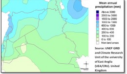
Climate change in relation to rainfall and temperature in Erbil province, Kurdistan, Iraq
by Ali Neji
0
Full Review »
Published Researches
Development of Water Resources in Koya City, Iraq
by Ali Neji
0
Full Review »
Published Researches
Geospatial and multi-criteria analysis to rank suitable sites of shallow aquifer recharge with reclaimed water: Application to Nabeul – Hammamet groundwater
by Ali Neji
0
Full Review »
Published Researches
URBAN FURNITURE IN CITIE OF DEVELOPING COUNTRIES
by Ali Neji
0
Full Review »
Page 3 of 8
‹ Previous
1
2
3
4
5
6
Next ›
Last »
The Latest
News
Articles and Interviews
Reporting Geo-sp
Published Researches
International Conference on Social and Human Sciences
Precision Technologies Role in the Study of Climate Change Impact
5th International Conference on Water, Energy, Food and Agricultural Technology Istanbul, Turkey, 22-25 January 2019
Bluesky’s LiDAR experts educate Mouchel’s water industry professionals
Creation of a digital 3-dimensional model
AeroMetric Announces New High Accuracy Mapping Solution
Interview with George Gartner
Measuring earth’s vital magnetic field
Selecting Suitable Sites for Wind Energy harvesting in Iraq using GIS Techniques
Machine Learning and Statically for Evaluating the Classification of Medical and Lab Services
Study the characteristics and nature of the Indian dates tree. Tamarindus Indica L In the southwestern region (Jizan and Asir)
More »
More »
More »
More »
 English
  Français
  العربية