You can work with maps in the field using Esri’s Collector for ArcGIS app on your iPhone or Android smartphone. You can also use maps to capture spatial and tabular data with the phone’s GPS or by tapping on the map...
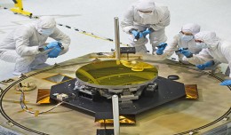
The sole secondary mirror and another primary mirror that will fly aboard NASA’s James Webb Space Telescope arrived at NASA’s Goddard Space Flight Center in Greenbelt, Md., on Nov....
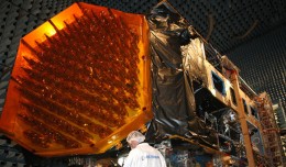
ARTES 8 Alphabus/Alphasat is dedicated to the development and deployment of the Alphasat satellite. Alphasat is being built in partnership between ESA and European operator Inmarsat by Astrium. It is the first satellite to us...
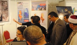
Dr. Monji Marzouk, Minister of communication and Information Technologies opened on Monday, April 8 2013 the activities of the 7th edition of the international congress geotunis held under the slogan: Through geographic infrast...
TogliattiKauchuk Plant – Togliatti, Russia Laser scanning as a method of storage of spatial information is used in various economic sectors. In this article, we will focus on laser scanning for industrial design, or more pr...
18 December 2012, Rome - The global forest products industry is slowly recovering from the economic crisis, with the Asia-Pacific region and particularly China taking the lead. New data published by FAO indicate that on avera...
RIEGL goes for ultra-long ranges: VZ-6000 offers more than 6,000 m measurement range Horn, Austria, September 24, 2012 – Especially designed for ultra-long range applications in topograp...
The Tunisian Association of Digital Geographic Information participates in the second scientific congress of desert studies in the Anbar University 24- 26 April 2013, the congress will be held under the slogan “scientific res...
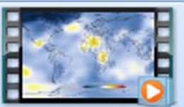
NASA scientists say 2012 was the ninth warmest of any year since 1880, continuing a long-term trend of rising global temperatures. With the exception of 1998, the nine warmest years in the 132-year record all have occurred sinc...
The Second session of the International Symposium Precision Technologies Role in the Study of Climate Change Impact and its implications on the Economic and Natural Structure: The reality and suggested solutions Istanbul, Turke...
Modeling Ripeness Grading of Palm Oil Fresh Fruit Bunches through Image Processing using Artificial Neural Network Osama M. Ben Saaed1, Meftah Salem M Alfatni1,2*, Abdul Rashid Mohamed Shariff3 and Hadya S Hawedi1 1Faculty of I...
Google released more than a quarter-century of images of Earth taken from space Thursday compiled into an interactive time-lapse experience. Working with data from the Landsat Program managed by the U.S. Geological Survey, the ...
 English
  Français
  العربية